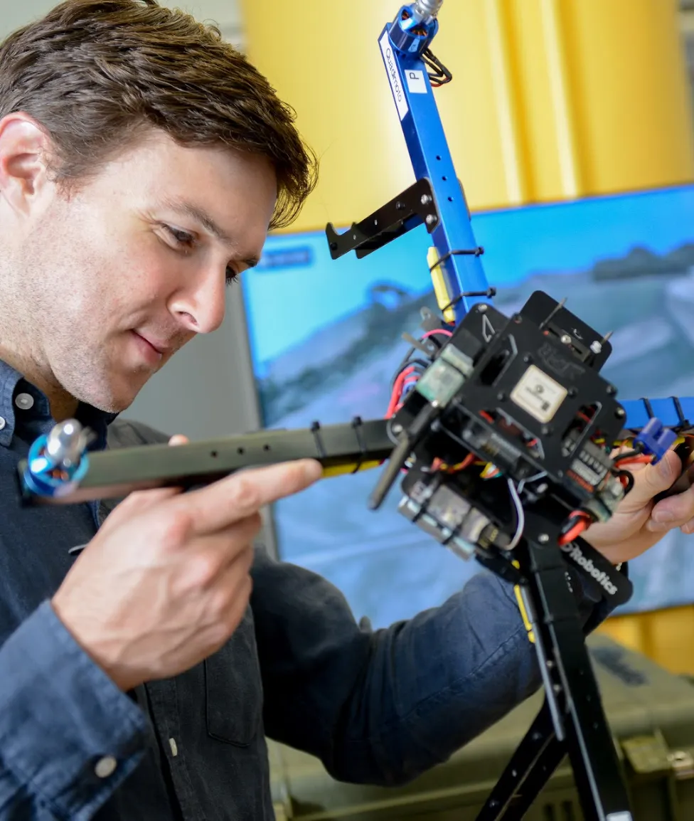
Introduction to UAS
Center for Geospatial Analytics at North Carolina State University
UAS: Unmanned Aircraft System
- Unmanned = without a person onboard (operated by automatic or remote control)
- Aircraft = able to fly
- System = associated elements related to safe operations (may include control stations, control links, support equipment, payloads, flight termination systems, and launch recovery equipment)
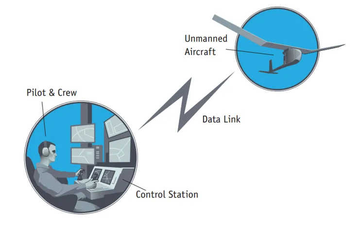
Consists of three elements:
- Unmanned Aircraft
- Control Station
- Data Link
UAS or UAV? Or maybe a drone?
Unmanned Aerial Vehicle (UAV)
- Excludes: missiles, weapons, or exploding warheads,
- Includes: all classes of airplanes, helicopters, airships, and powered-lift aircraft,
- Doesn’t include: traditional balloons, rockets, tethered aircraft, and un-powered gliders.

Different shapes and sizes
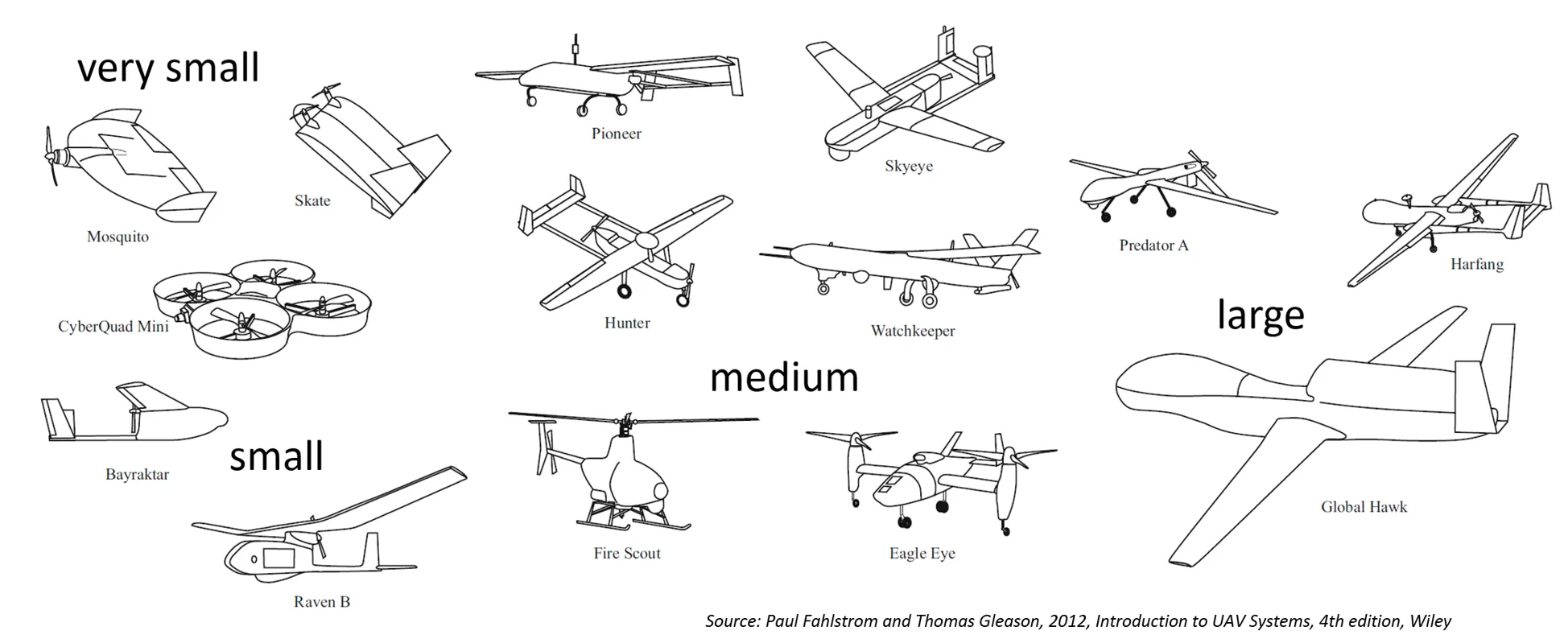
Different Designs
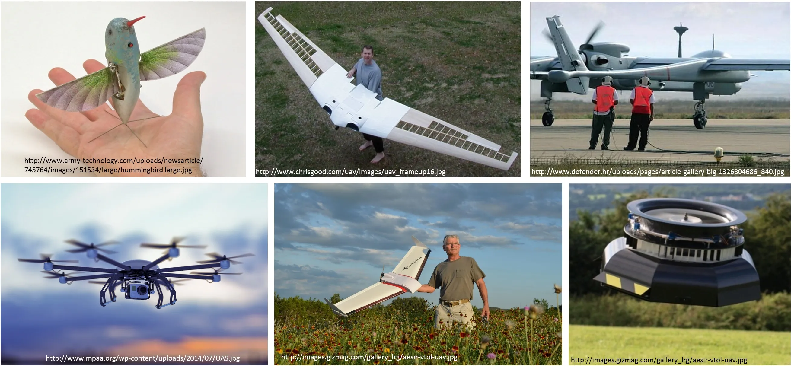
Different Classifications
- Physical size
- Weight
- Endurance
- Altitude
- Wing loading
- Engine type
- Range
- Performance
- Capabilities
- Type
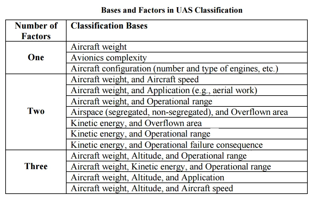
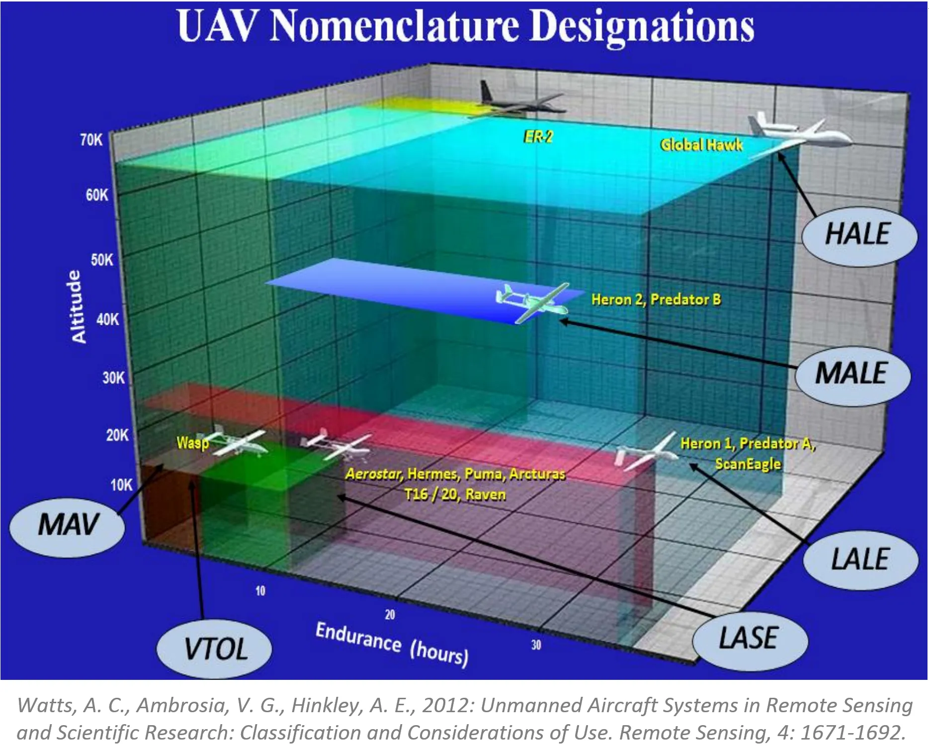
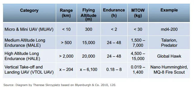
Simplified classifications
- More (much much more) about classifications in the article
- Condensed basics including classification can be found in Unmanned Aircraft Systems for Civilian Missions
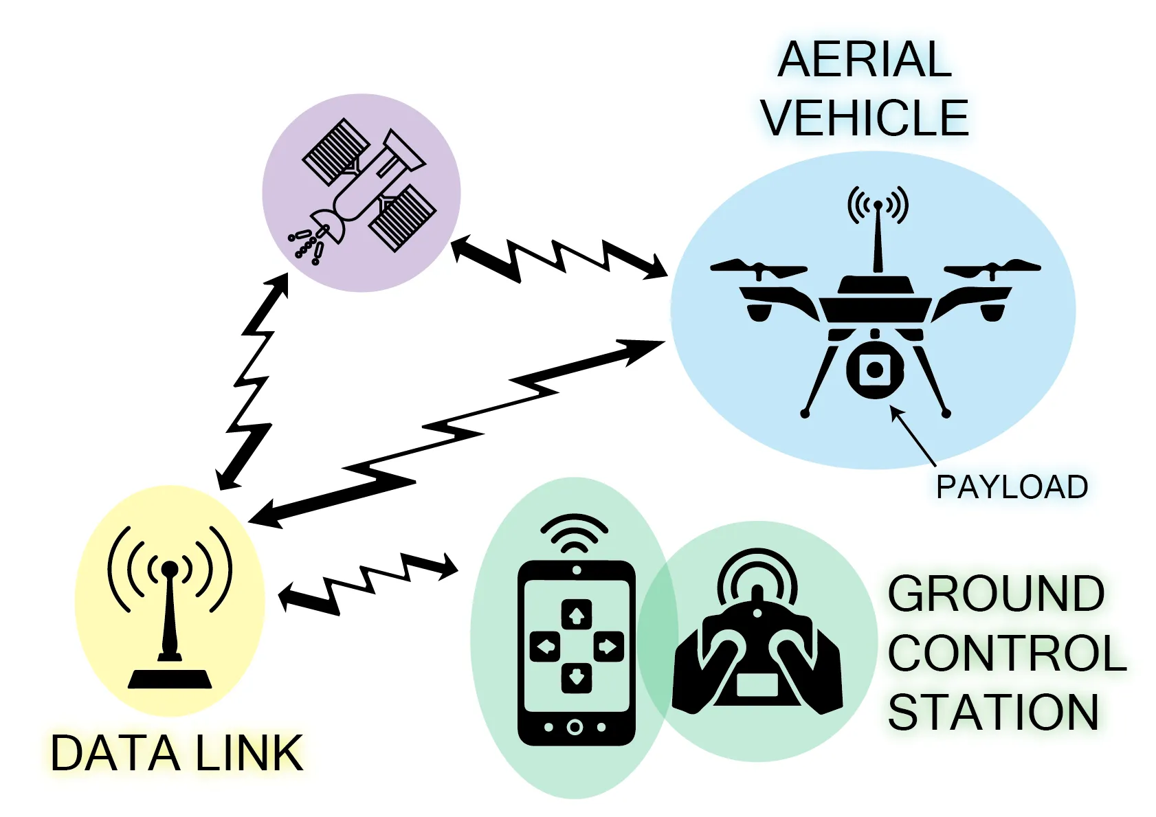
Generic Unmanned Aircraft System
- Air vehicle
- Mission planning element
- Command and control element
- Communication link
- Launch and recovery element (for some of them)
- Payload
Sensors
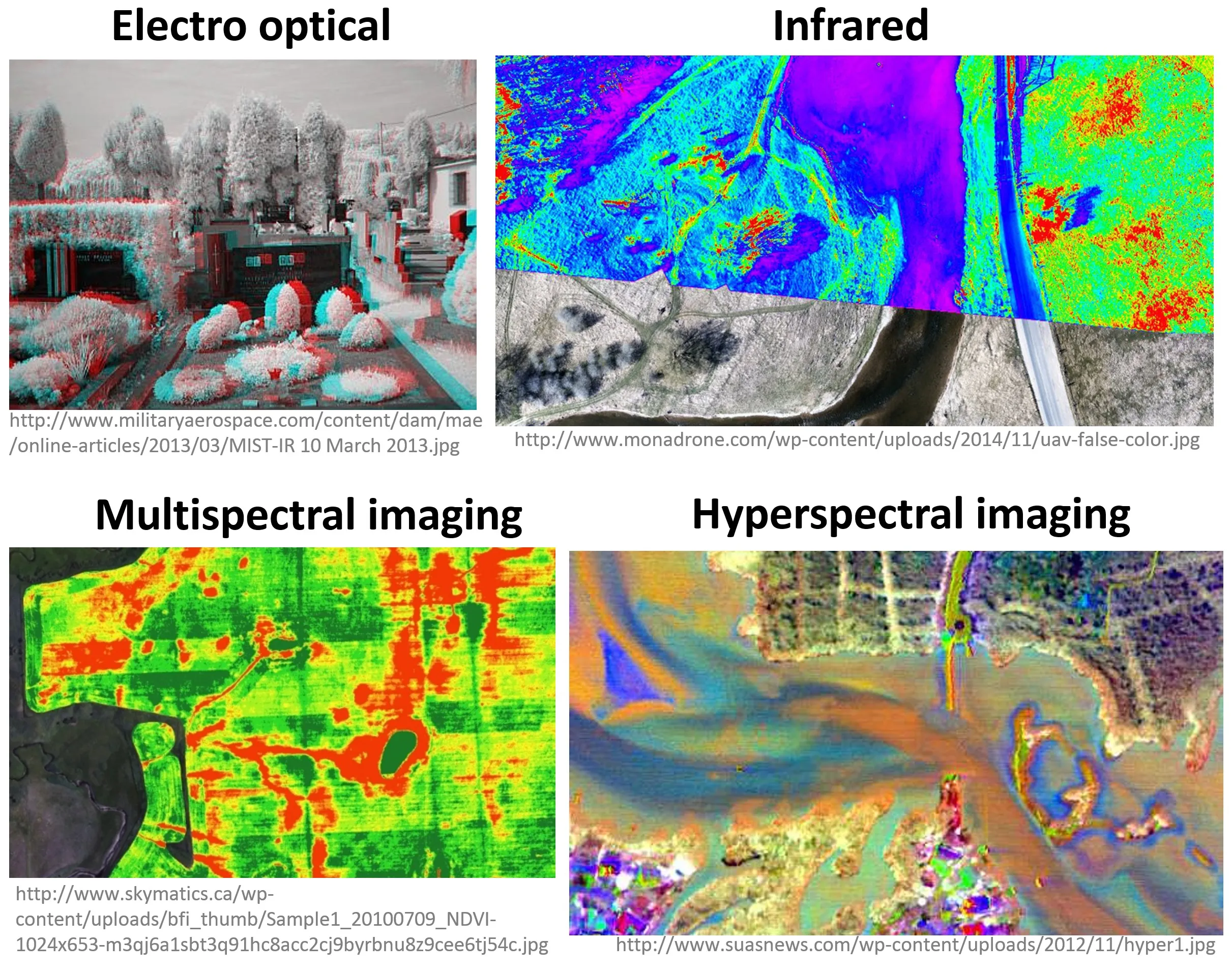
Sensors
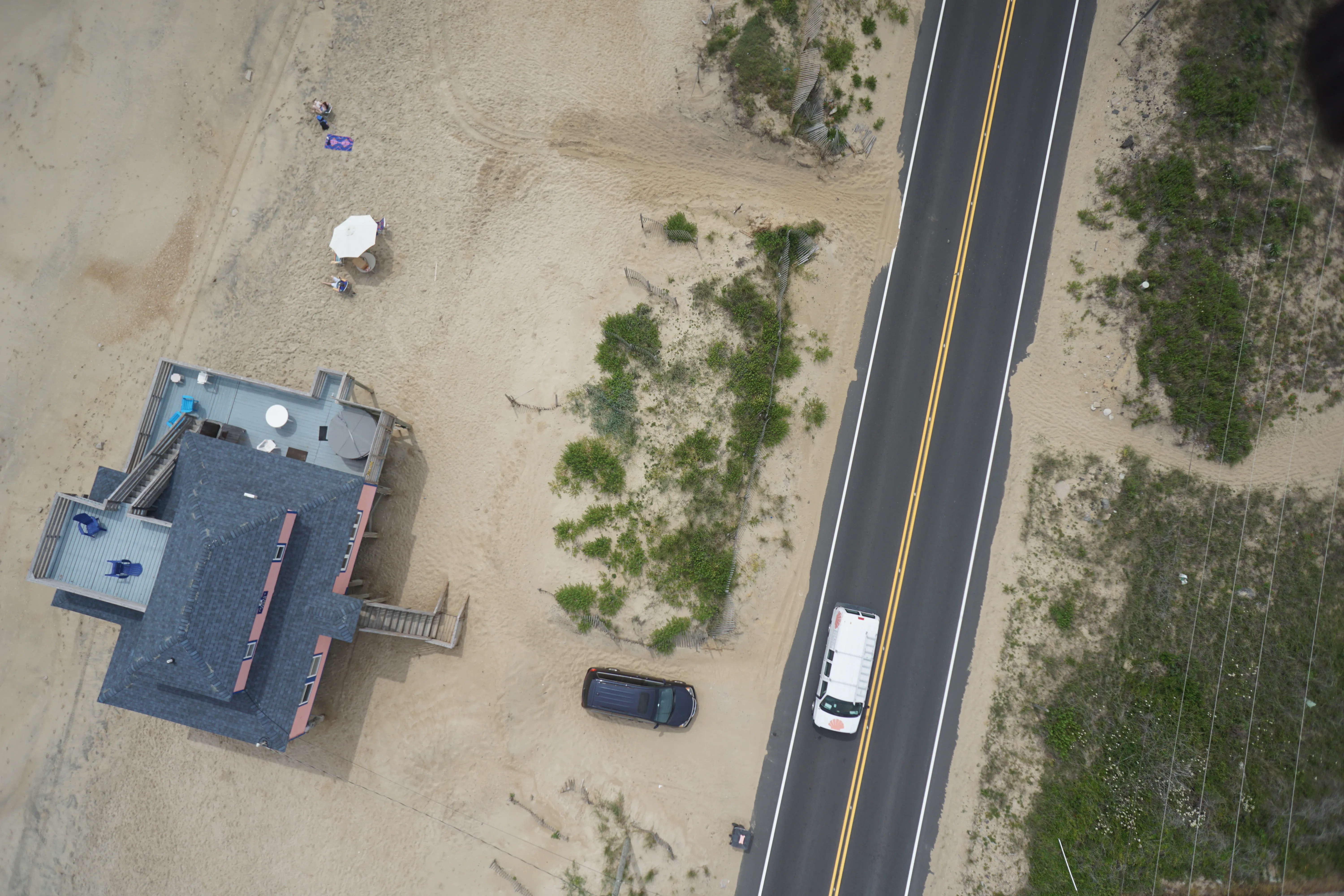
RGB (natural color) cameras
- Most common payload for consumer-grade UAS
- Photo or video mode
- Mapping (orthophoto and DSM generation) possible even with non-photogrammetric cameras
- Variety of cameras, lenses, and mounting systems - some suitable for 3D modeling
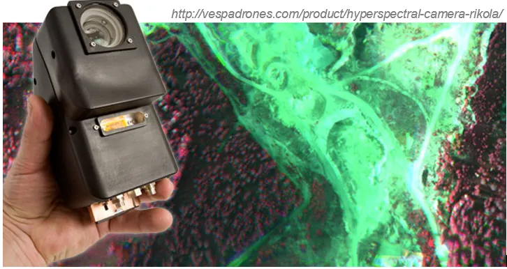
Multispectral and hyperspectral cameras
- Miniaturization is challenging in terms of optics and sensor calibration
- Weight, cost, data quality has improved; spectral bands, resolution need improvements
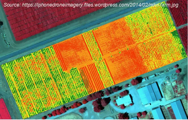
- Cameras with NIR band: agriculture and vegetation mapping (for NDVI)
- The more bands the more information, but also higher price of the sensor
- $$ multispectral - couple thousands
- $$$ hyperspectral - tens of thousands
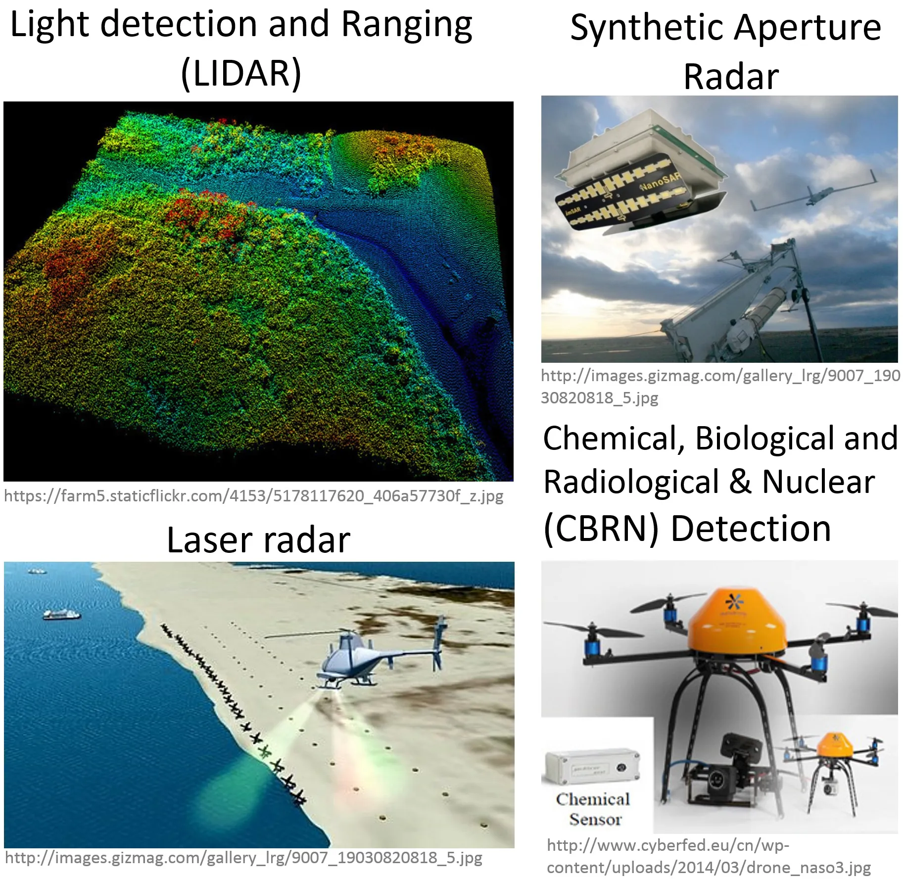
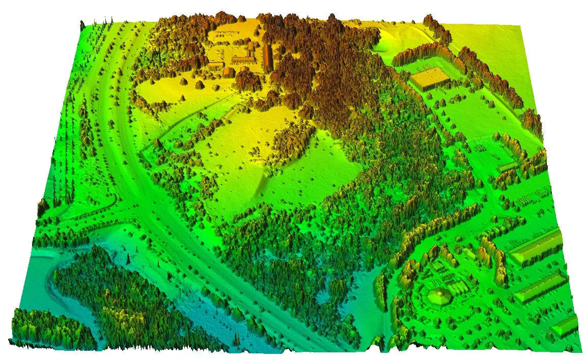
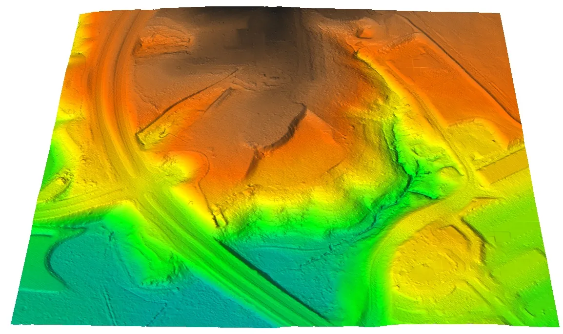
Active sensors - LiDAR and SAR
- Active sensors can reach below-canopy ground surface
- Large trade-offs between performance and size or cost of LiDAR
- LiDAR now common on UAS thanks to miniaturization
- SAR (Synthetic Aperture Radar) used experimentally, still faces challenges in adaptation to UAS
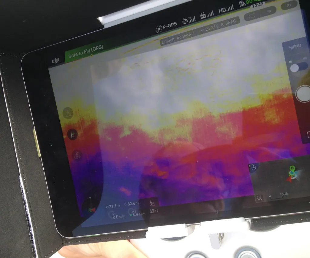
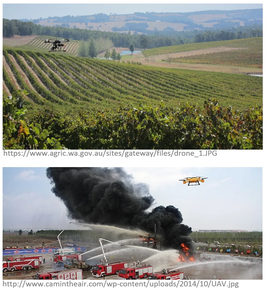
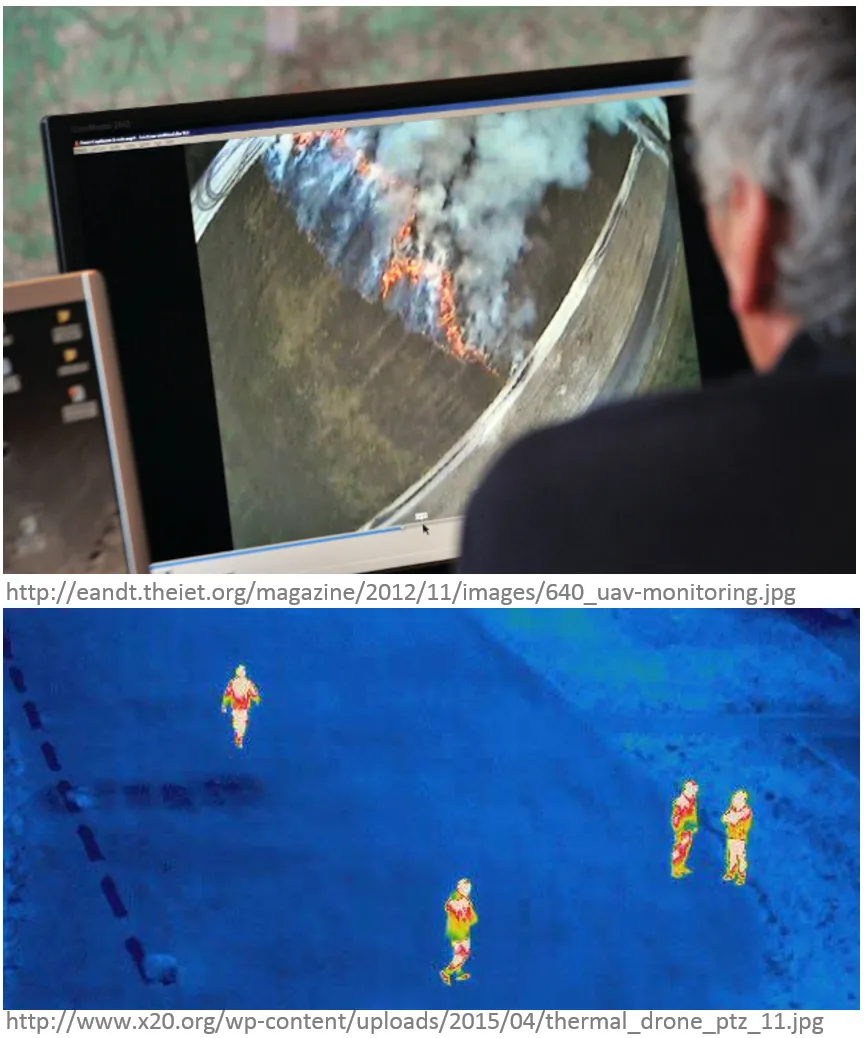
Thermal imaging
- Used in forest fire monitoring, search and rescue missions
- For mapping purposes coupled with visible band sensors (see example FLIR DUO)
Sensor and platform integration
The optimal combination of carrier (Unmanned Vehicle) and sensing payload needs to be determined based on:
- Volume, size, and weight specifications
- Specific application requirements
- Mounting: integrated by manufacturer or custom solutions
- The sensors must be adapted to the carrier and vice versa
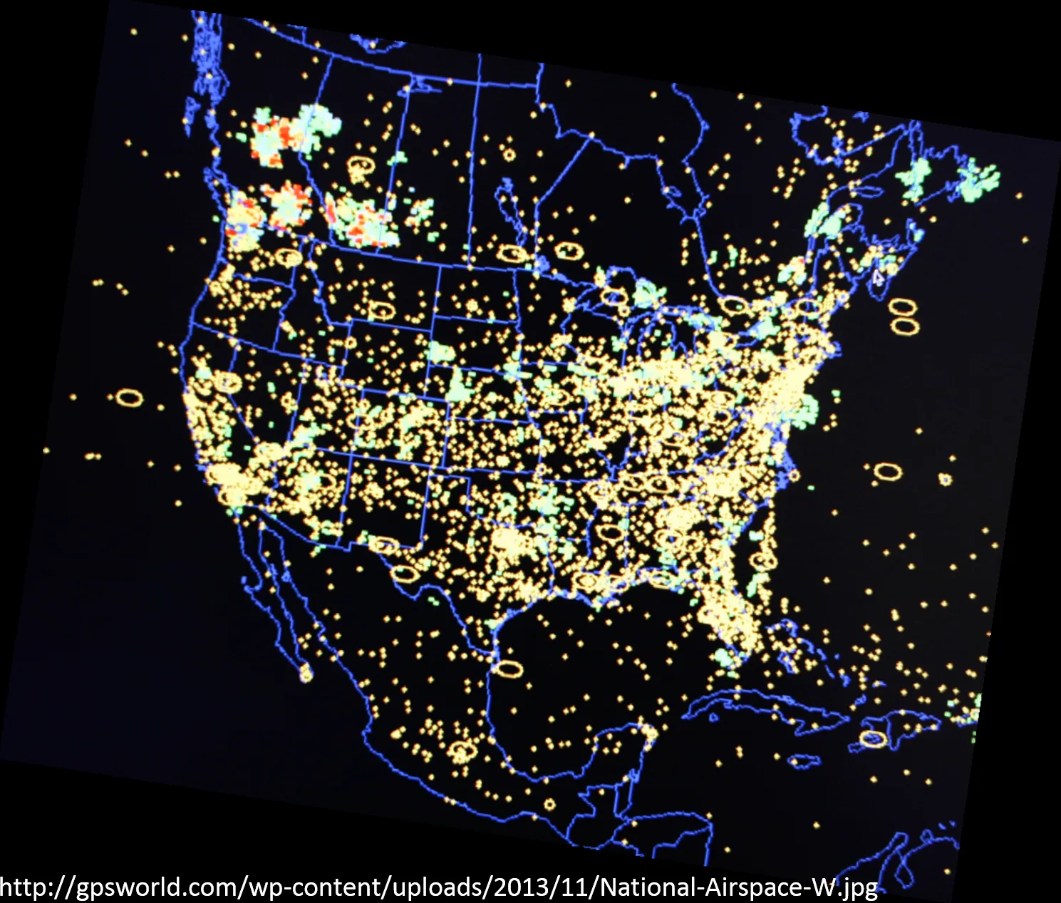
FAA – Federal Aviation Administration
NAS – National Airspace System
The common network of U.S. airspace:
- air navigation facilities, equipment, and services;
- airports or landing areas;
- aeronautical charts, information and services;
- rules, regulations, and procedures;
- technical information; and manpower and material.
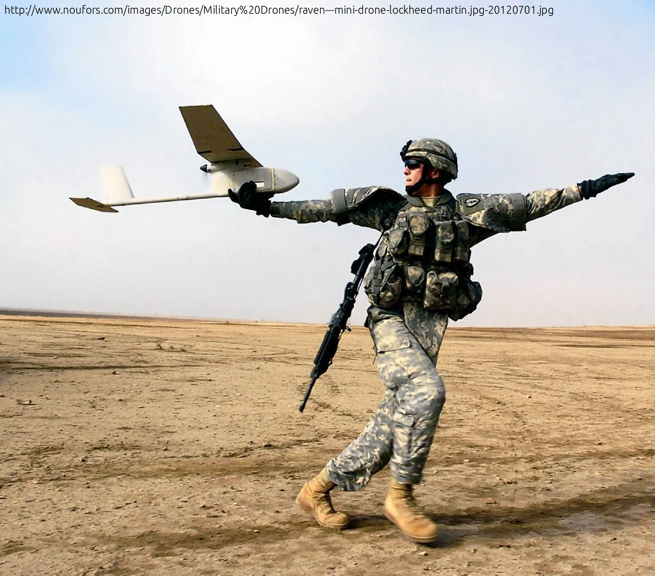
Army and Government
- Department of Agriculture
- Department of Commerce
- Department of Defence
- Department of Energy
- Department of Homeland Security
- Department of Interior
- Department of Justice
- NASA
- NOAA
- State Universities
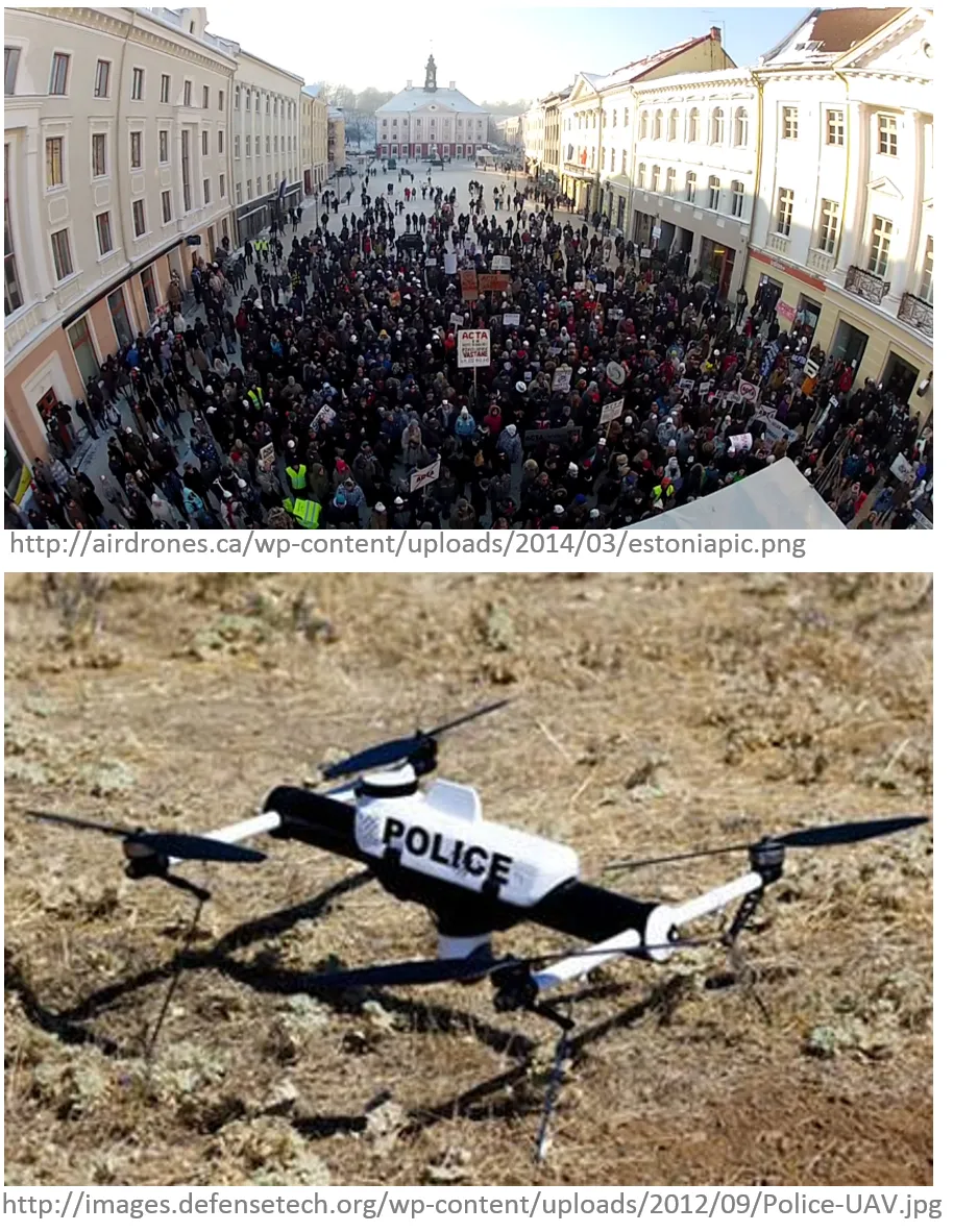
- State Law Enforcement
Civilian Application Fields
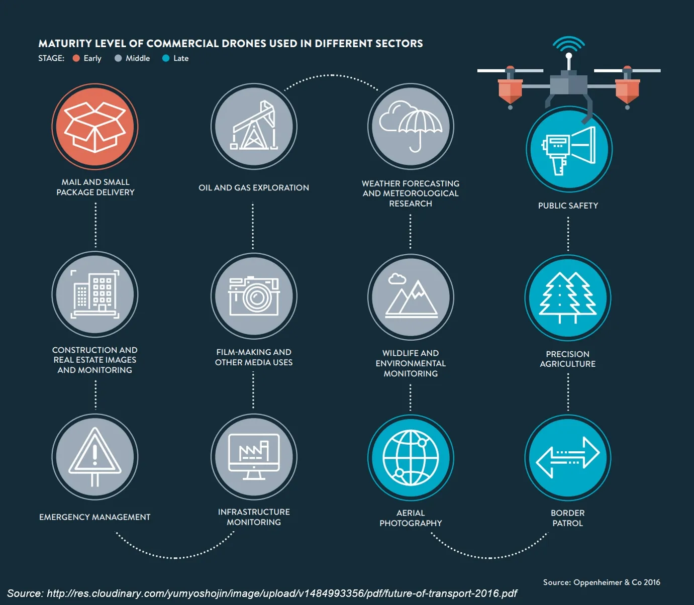
Application Examples (1)
- Agriculture:
- UAS equipped with fertilizer and pesticide dispersing equipment can be used to spray over large fields;
- Telecommunications:
- As mobile relay platforms, e.g., in disaster zones for emergency telecommunications
Application Examples (2)
- News Broadcasting:
- In providing aerial video feeds for news events;
- Air Traffic Control and Ground Traffic Control:
- To monitor traffic and accidents over highways and streets, capture violation of traffic rules;
Application Examples (3)
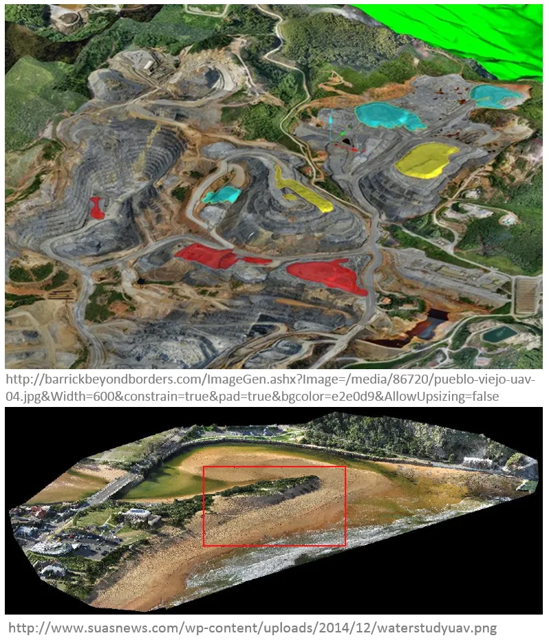
- Mineral Exploration:
- In aerial survey, to find minerals in hard-to-reach regions;
- In existing mines, to map extracted material volumes;
- Coastal Monitoring:
- Mapping dynamic shorelines and post-storm assessment
UAS for Remote Sensing (1)
- Agriculture and Environment:
- Crop monitoring, vegetation mapping, forest fire monitoring, animals detection;
- Intelligence, Surveillance, and Reconnaissance:
- Detection of lost persons in difficult-to-access situations, support fire brigades in real-time crisis management, rapid disaster management;
UAS for Remote Sensing (2)
- Aerial Monitoring in Engineering:
- Infrastructure inspections, distributed wind measurement, landslide monitoring;
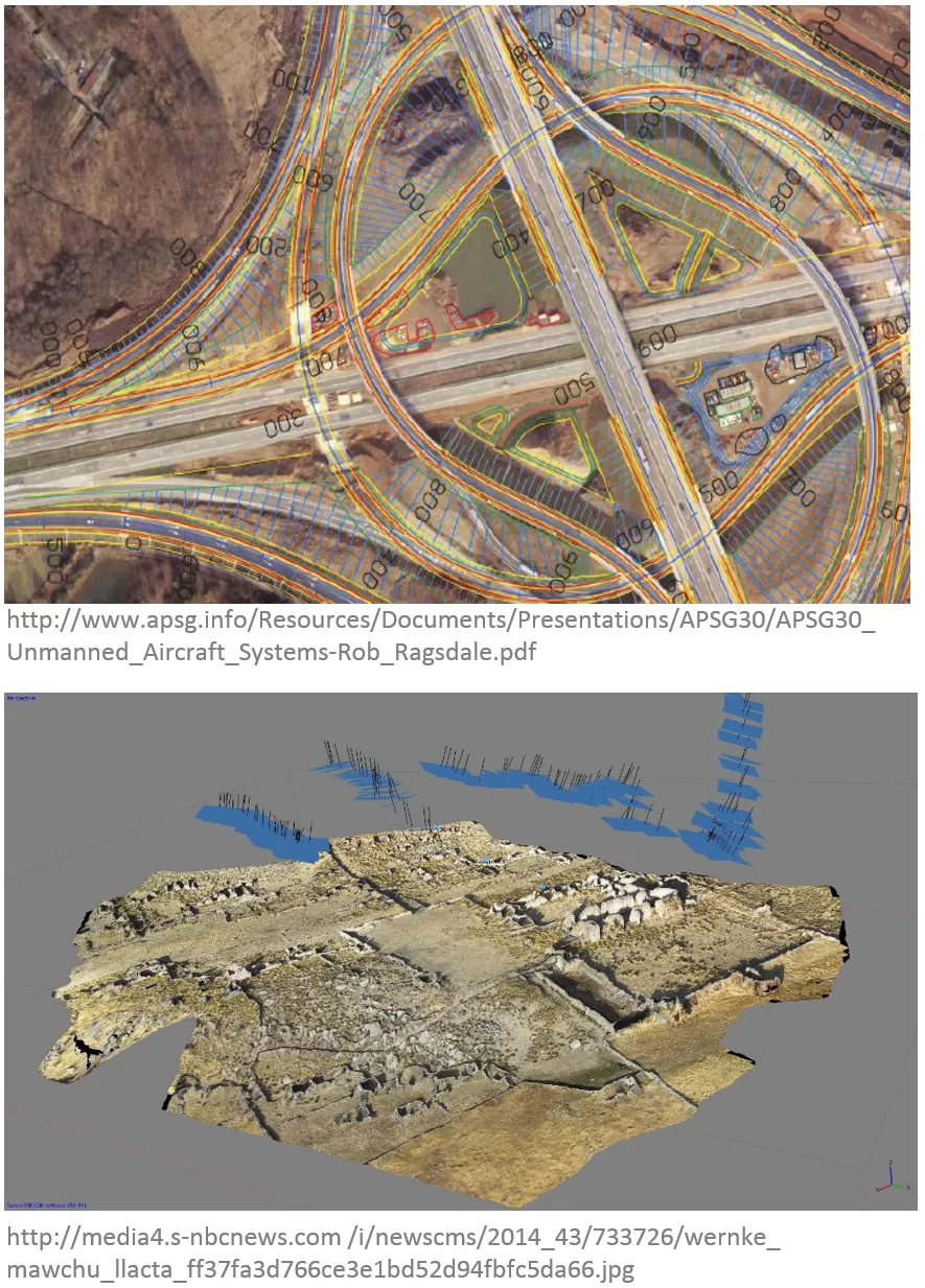
- Cultural Heritage:
- Orthophotos of archaeological sites, 3D models of man-made structures;
UAS for Remote Sensing (3)
- General surveying, mapping, and photogrammetry, cadastral applications:
- Cadastral surveying, alternative to traditional surveying, high-precision parcel boundary determination;
Why should you know how to use UAS?