Open Science Publication
Vaclav (Vashek) Petras
NCSU GeoForAll Lab
at the
Center for Geospatial Analytics
North Carolina State University

GIS 710: Geospatial Analytics for Grand Challenges
November 18, 2024
Use Case
Petras et al. 2017
Petras, V., Newcomb, D. J., & Mitasova, H. (2017). Generalized 3D fragmentation index derived from lidar point clouds. In: Open Geospatial Data, Software and Standards 2(1), 9. DOI 10.1186/s40965-017-0021-8
Open Science Publication Components
| Publication Component | in the Petras et al. 2017 use case |
|---|---|
| Text | background, methods, results, discussion, conclusions, … (OA) |
| Data | input data (formats readable by open source software) |
| Reusable Code | methods as GRASS GIS modules (C & Python) |
| Publication-specific Code | scripts to generate results (Bash & Python) |
| Computational Environment | details about all dependencies and the code (Docker, Dockerfile*) |
| Versions | repository with current and previous versions* (Git, GitHub) |
* Version associated with the publication included also as a supplemental file.
Petras, V. (2018). Geospatial analytics for point clouds in an open science framework. Doctoral dissertation. URI http://www.lib.ncsu.edu/resolver/1840.20/35242Open Science Publication: In a Single Package Online
- Components other than Text and Versions for Petras et al. 2017 are now also available at Code Ocean as a capsule.
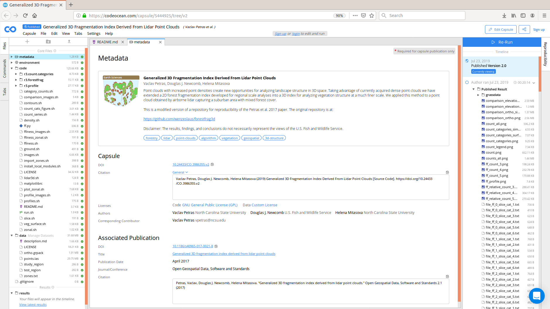
DOI 10.24433/CO.3986355.v2
