Payam Tabrizian, Brendan Harmon, Anna Petrasova, Vaclav Petras, Helena Mitasova
Tangible interfaces for geospatial modeling
Couple physical and digital geospatial models
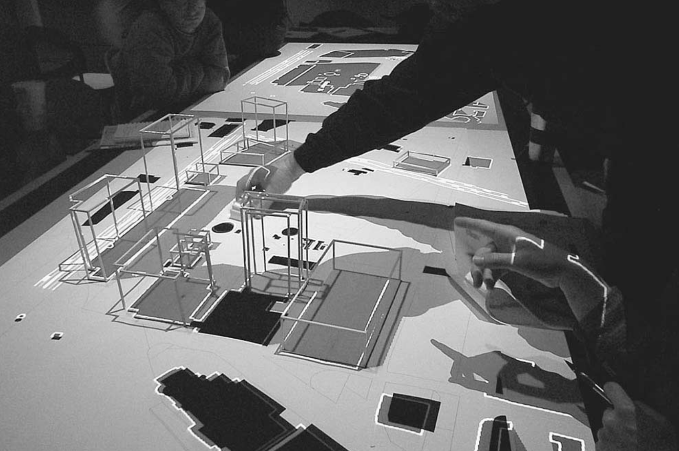
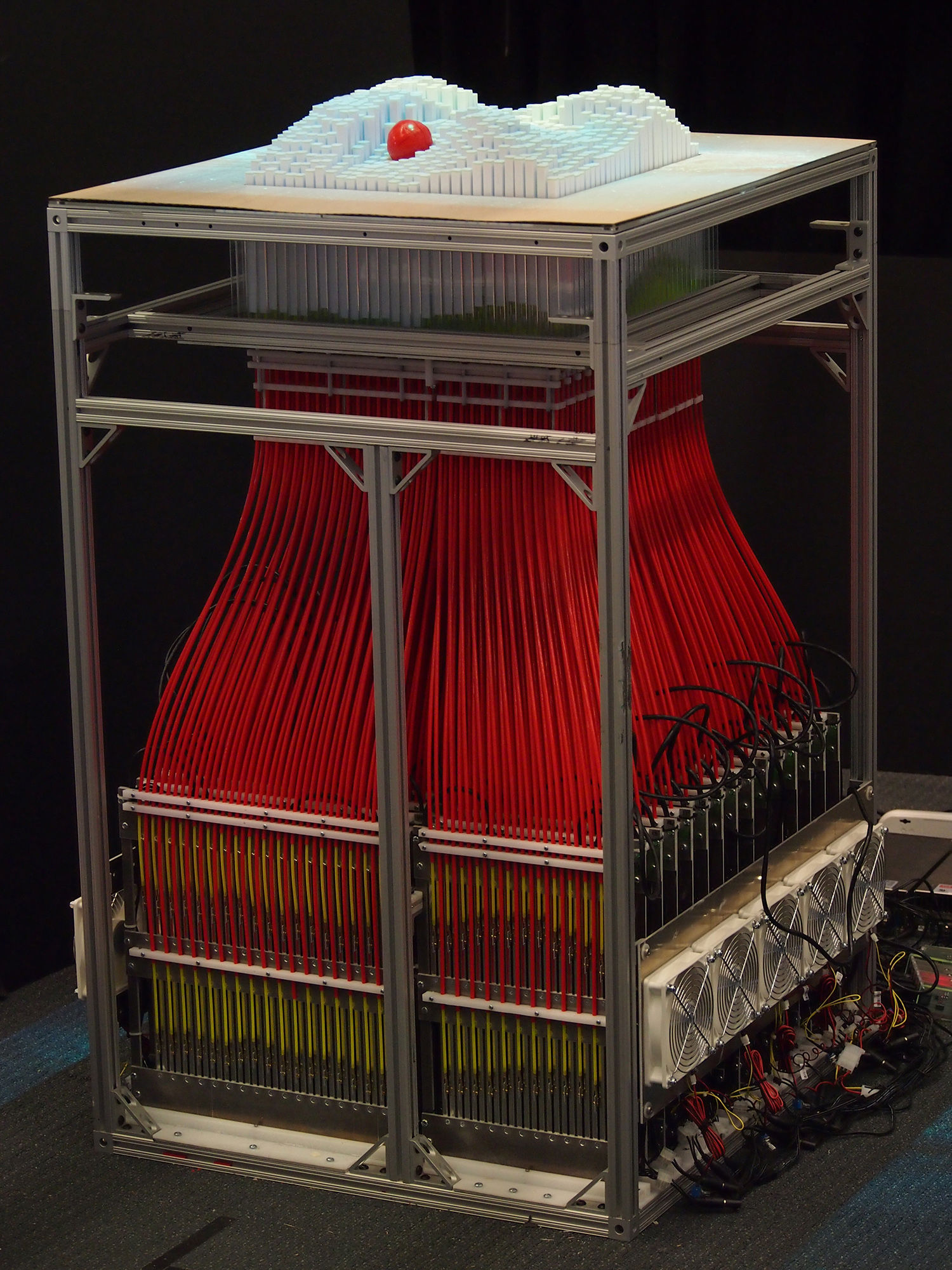
Augmented architectural models
Urp, 1996-2001
John Underkoffler and Hiroshi Ishii. 1999. Urp: a luminous-tangible workbench for urban planning and design. In CHI ’99 Proceedings of the SIGCHI conference on Human Factors in Computing Systems. New York, New York, USA: ACM Press, 386–393. DOI:http://dx.doi.org/10.1145/302979.303114
H. Ishii, C. Ratti, B. Piper, Y. Wang, A. Biderman, and E. Ben-Joseph. 2004. Bringing Clay and Sand into Digital Design — Continuous Tangible user Interfaces. BT Technol. J. 22, 4 (2004), 287–299. DOI:http://dx.doi.org/10.1023/B:BTTJ.0000047607.16164.16
Gerhard Schubert, Sebastian Riedel, and Frank Petzold. 2013. Seamfully connected: Real working models as tangible interfaces for architectural design. In Global Design and Local Materialization. Springer-Verlag Berlin Heidelberg, 210–221. DOI:http://dx.doi.org/10.1007/978-3-642-38974-0_20
Sean Follmer, Daniel Leithinger, Alex Olwal, Akimitsu Hogge, and Hiroshi Ishii. 2013. inFORM: dynamic physical affordances and constraints through shape and object actuation. In Proceedings of the 26th annual ACM symposium on User interface software and technology - UIST ’13. New York, New York, USA: ACM Press, 417–426. DOI:http://dx.doi.org/10.1145/2501988.2502032
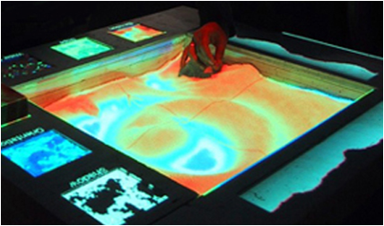
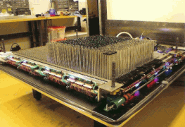
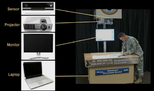
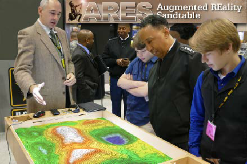
The Augmented REality Sandtable (ARES), 2015-present
Charles R. Amburn, Nathan L. Vey, Michael W. Boyce, and MAJ Jerry R. Mize. 2015. The Augmented REality Sandtable ( ARES ). US Army Research Laboratory. ARL-SR-0340. DOI:http://dx.doi.org/10.13140/RG.2.1.2685.0006
Source: US Army Research Laboratory
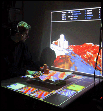
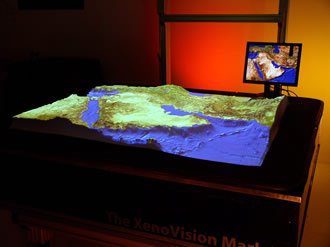
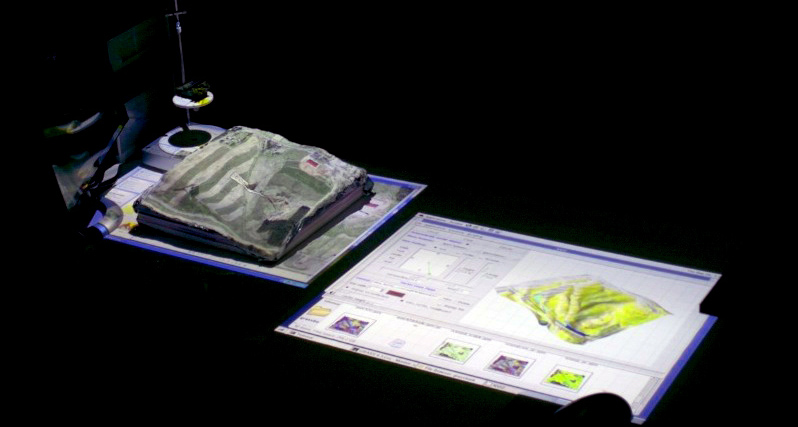
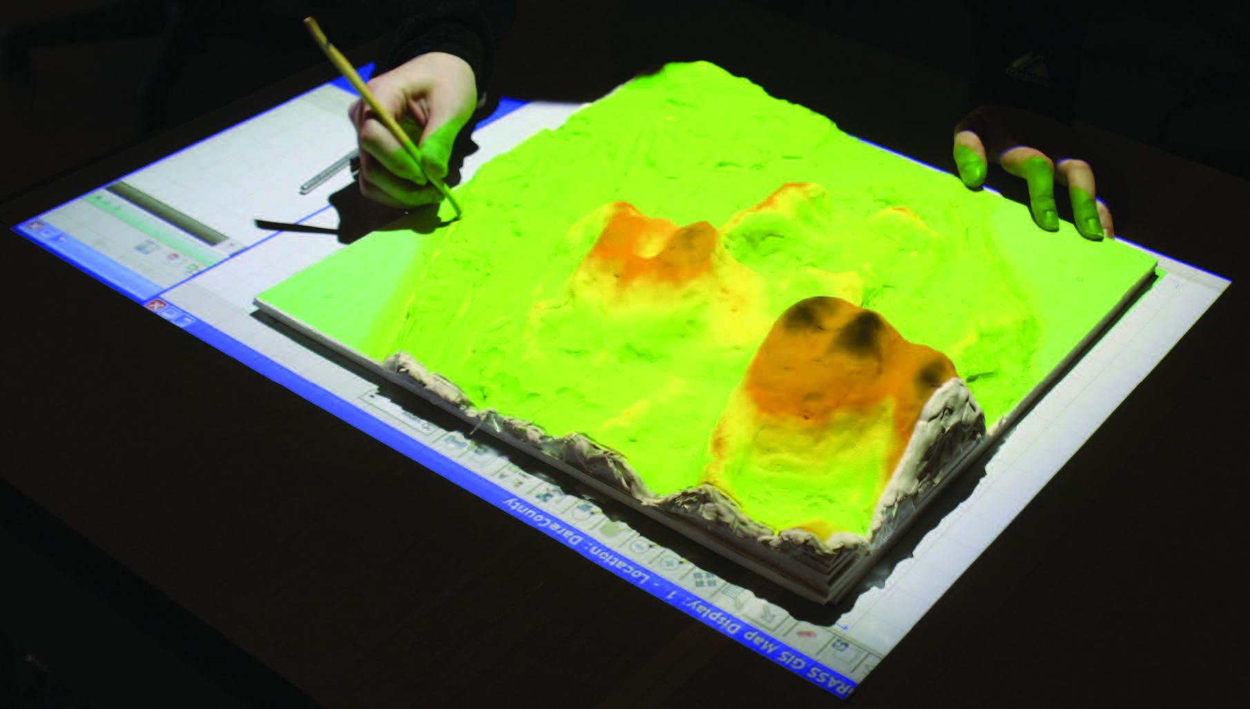
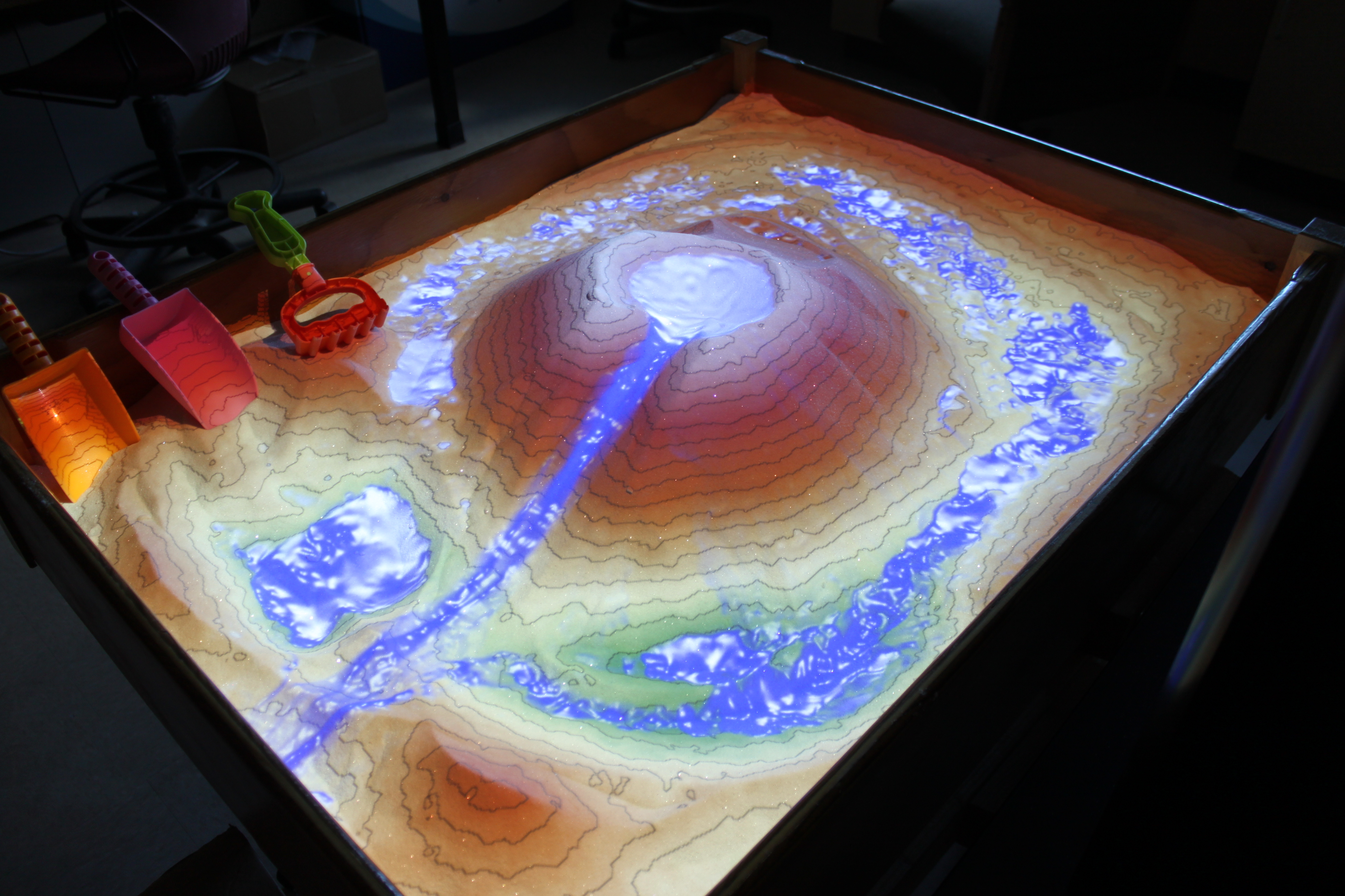
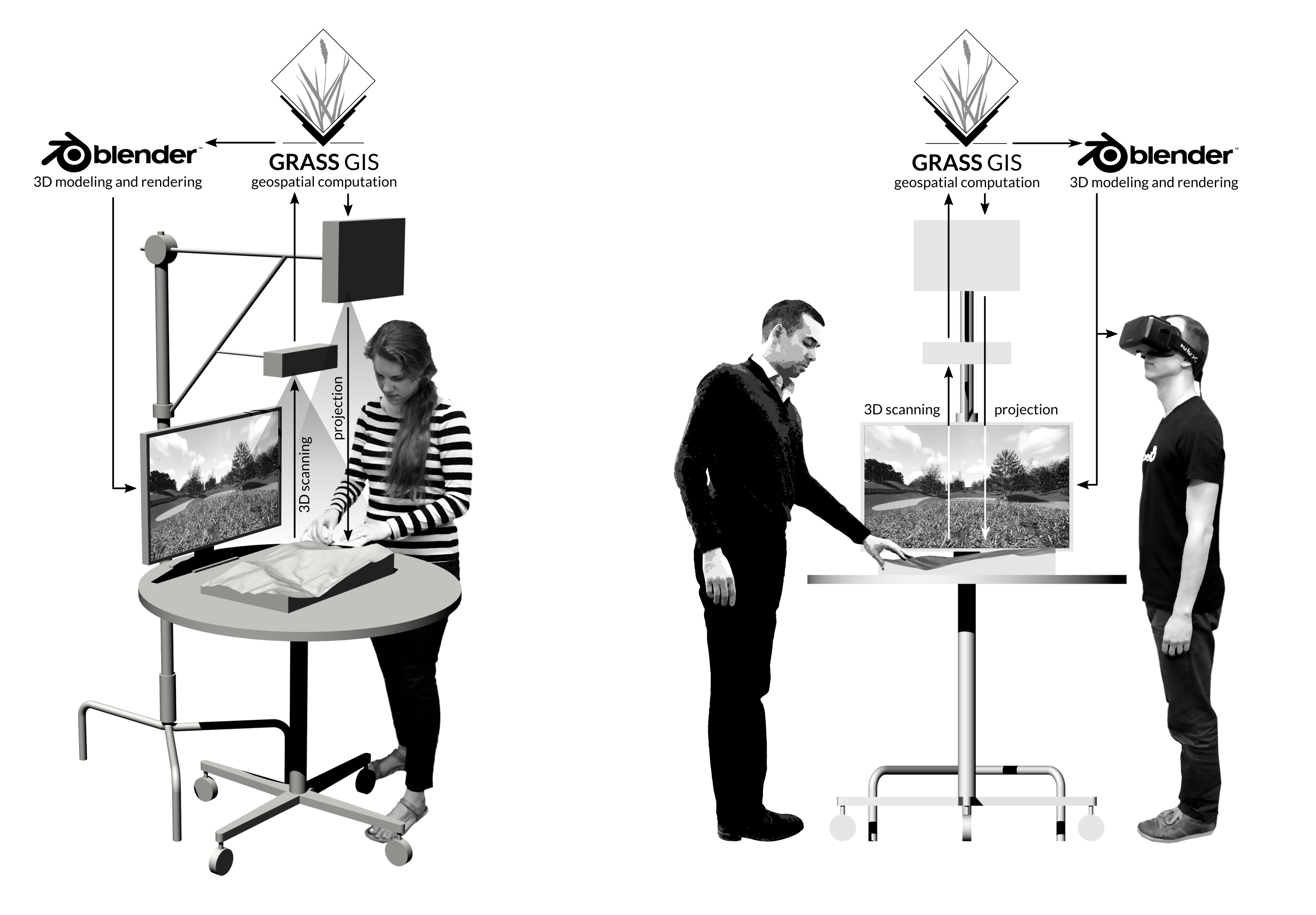
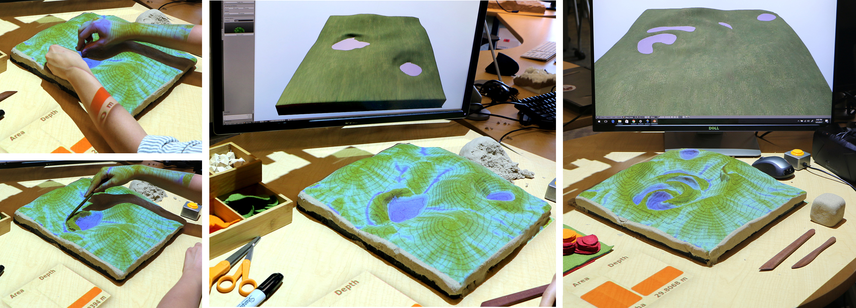
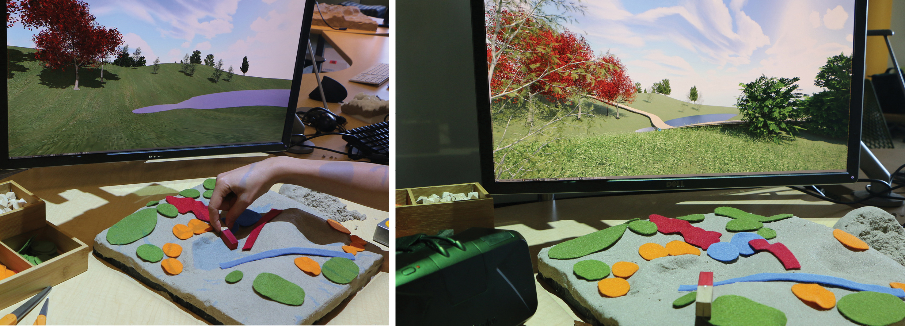
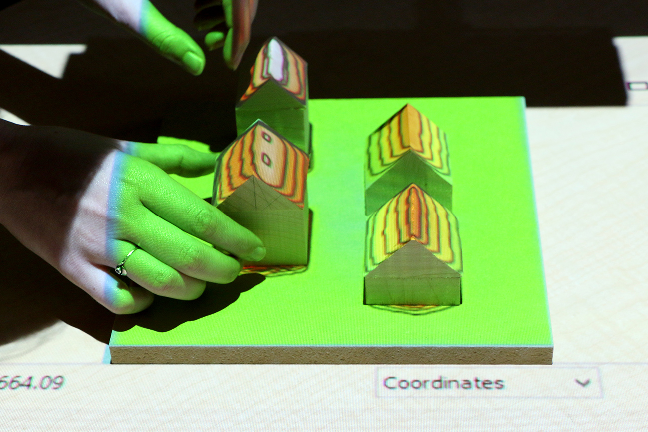
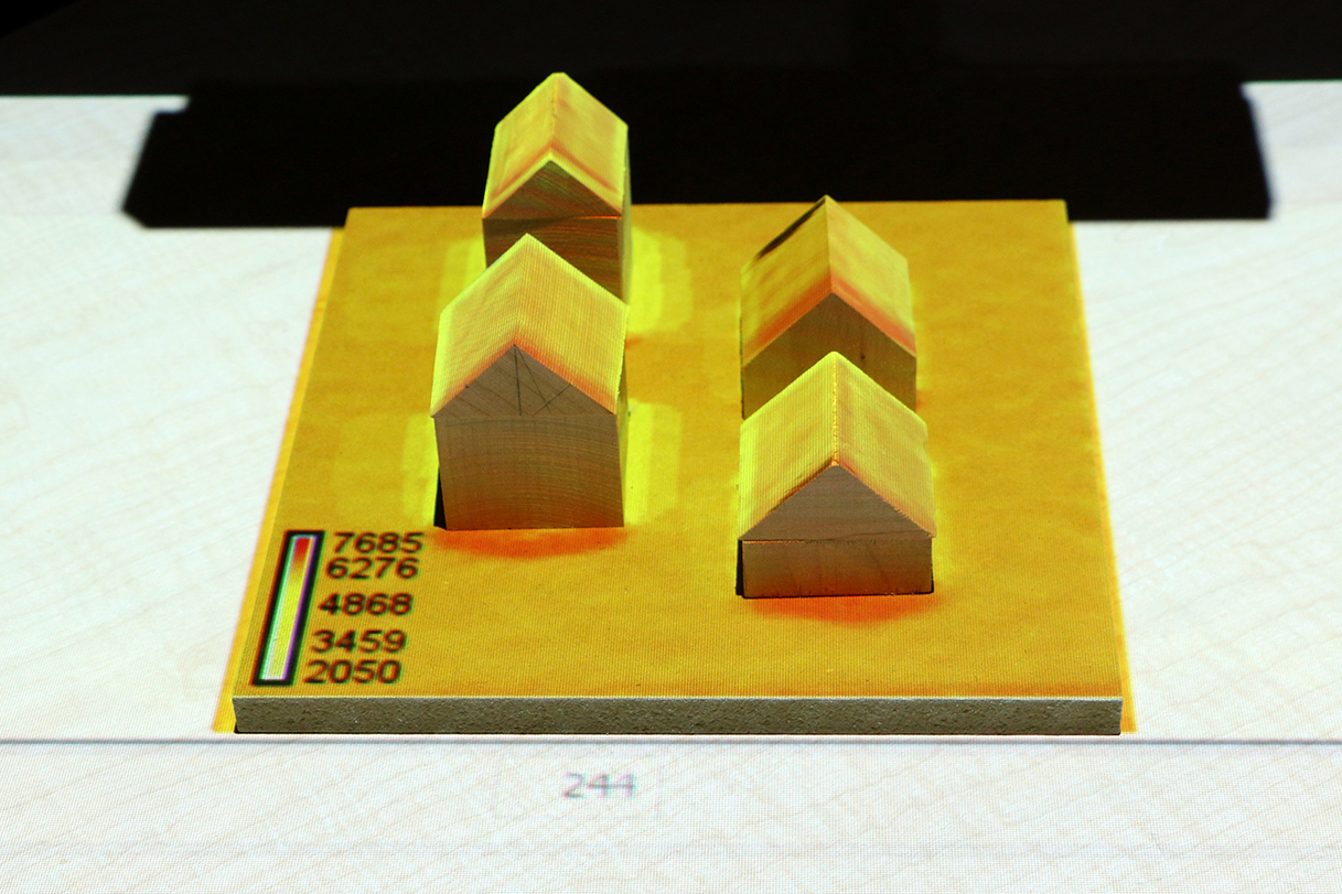
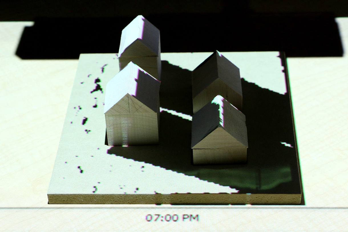
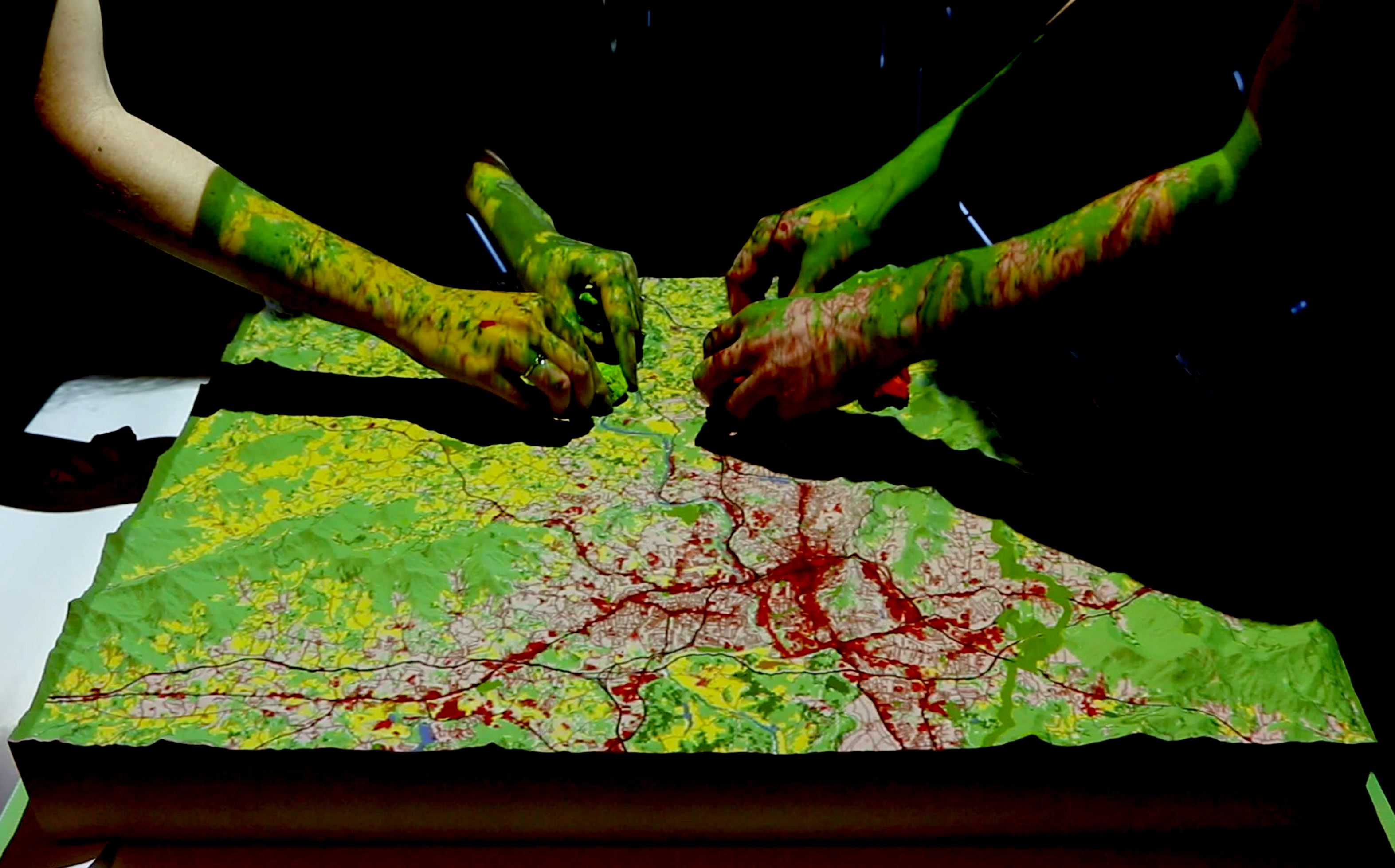
Tangible Landscape
A tangible user interface powered by open source GIS
2013-present
Tangible interaction with GIS
With Tangible Landscape you can hold a GIS in your hands - feeling the shape of the earth, sculpting its topography, and directing the flow of water.
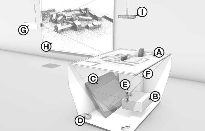
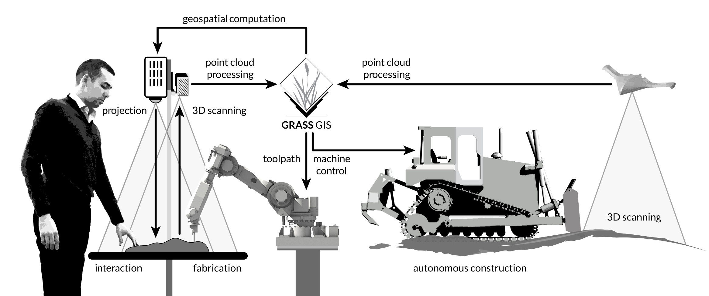
How it works ?
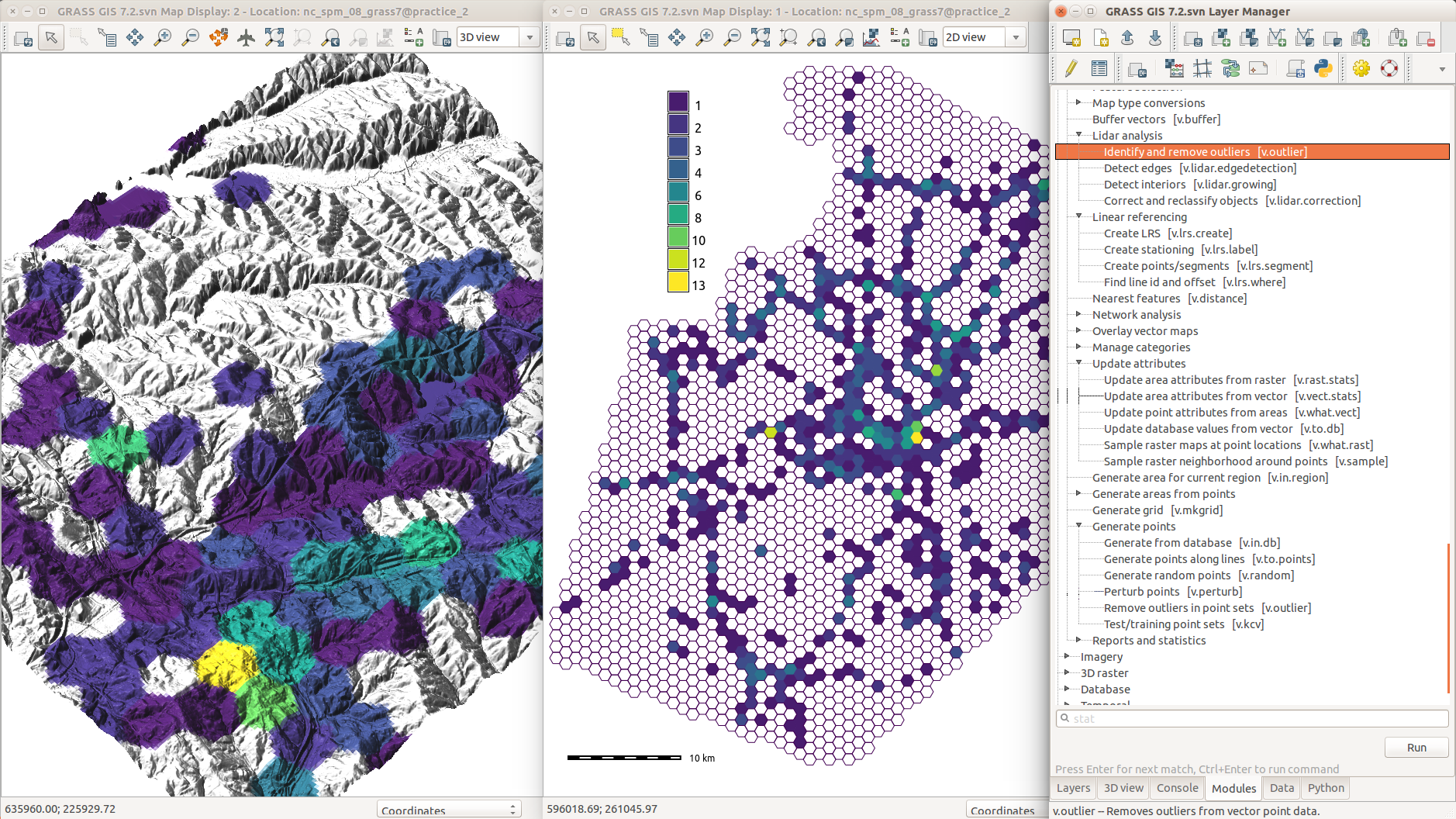
GRASS GIS
Geographic Information System
Free and open source
Extensive Library
Easy scripting in Python, fast algorithms in C/C++
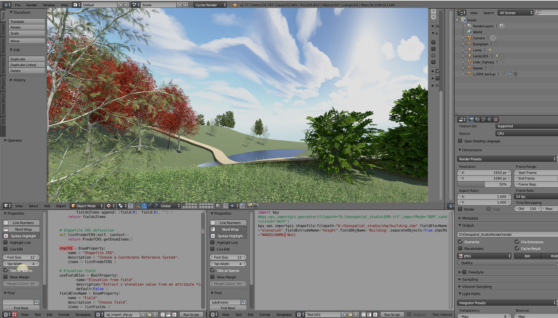
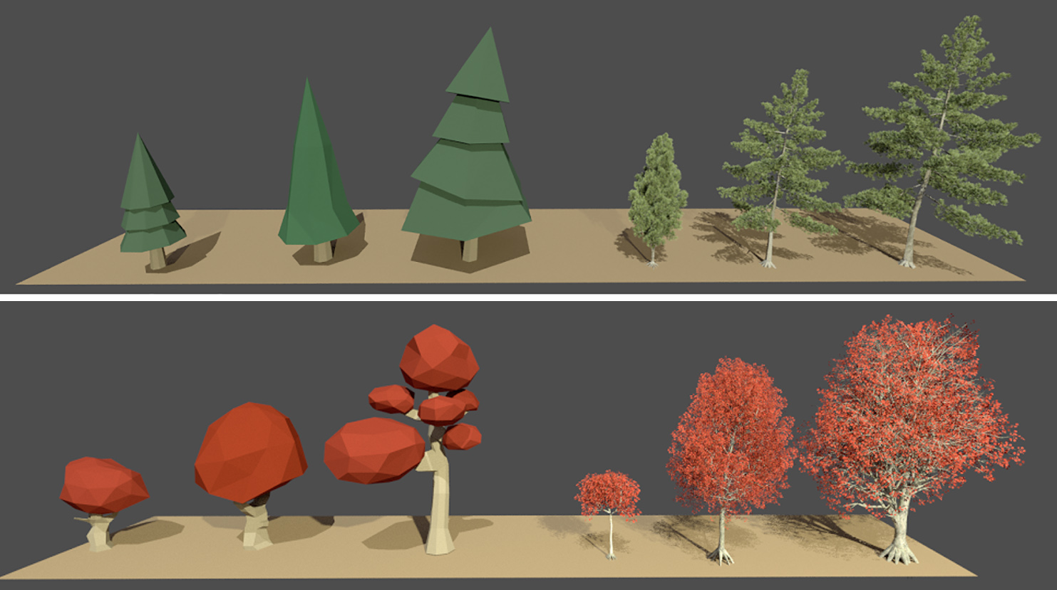
Blender
3D modeling, rendering, animation, physics, and game engine
Free and open source, easy scripting in Python
GIS and VR plugins
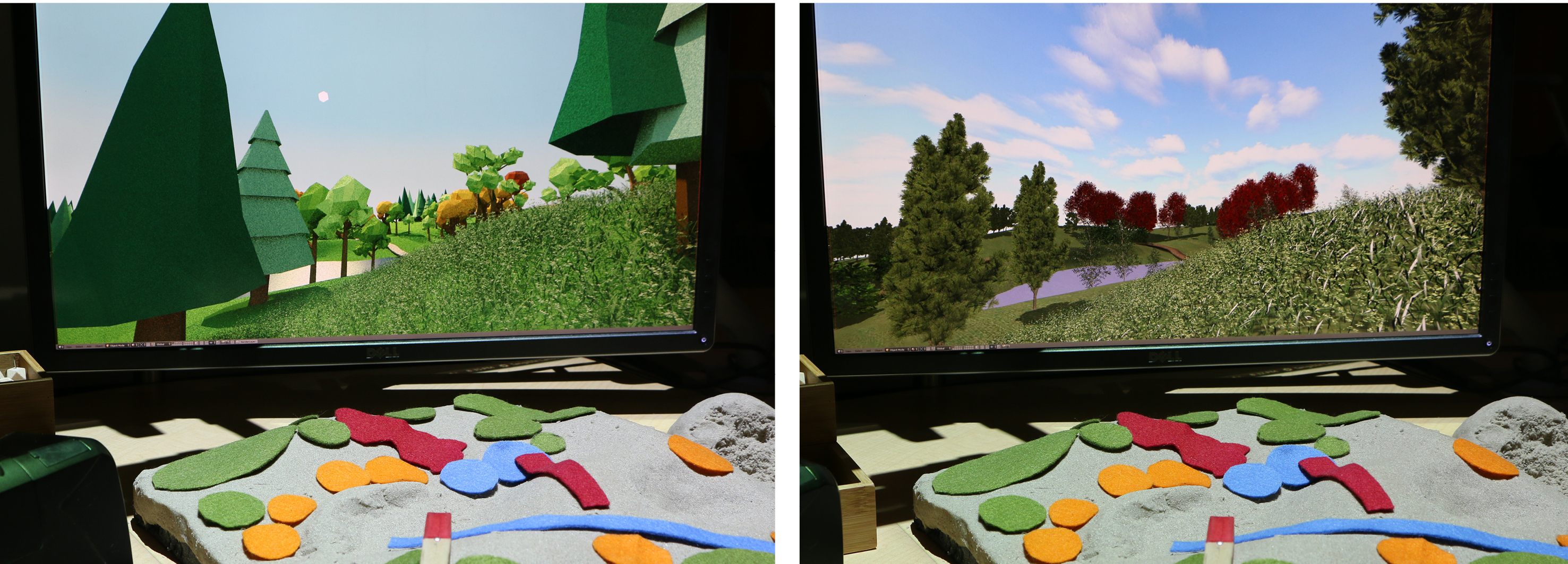
Real-time raytraced rendering
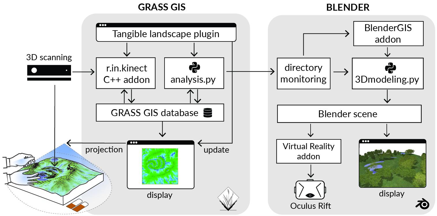
Software Architecture
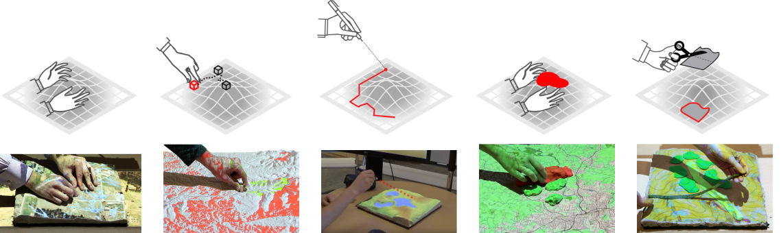
Interactions
surface
points
lines
areas
areas
Landform and water
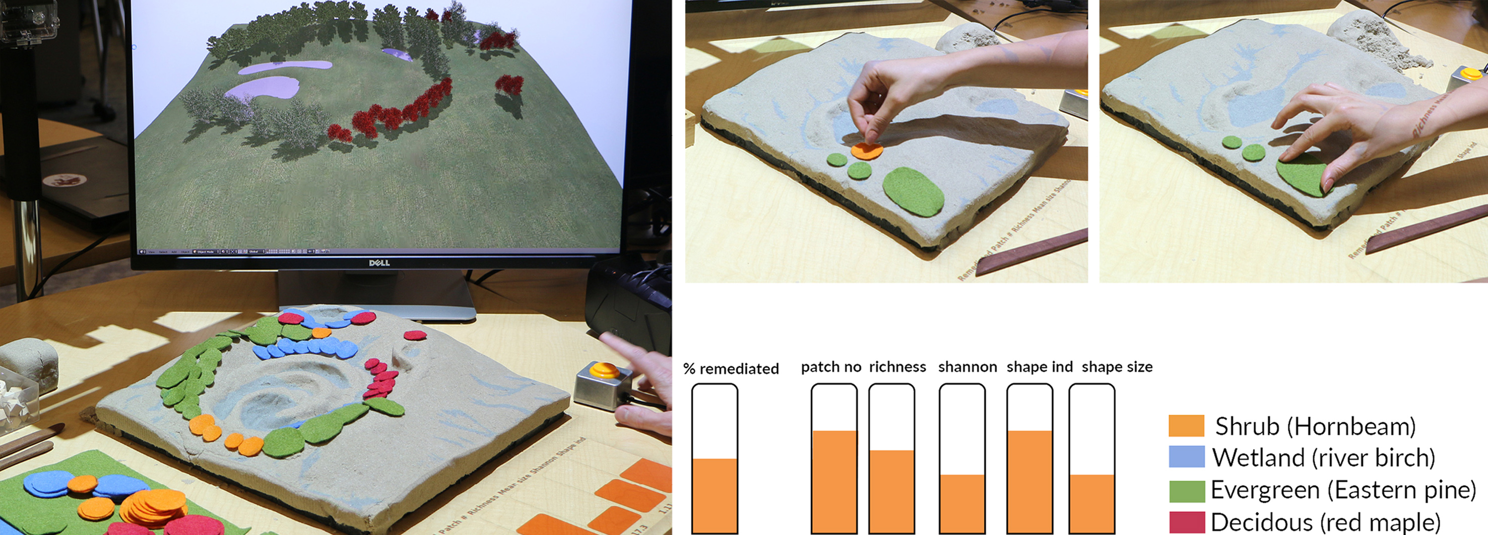
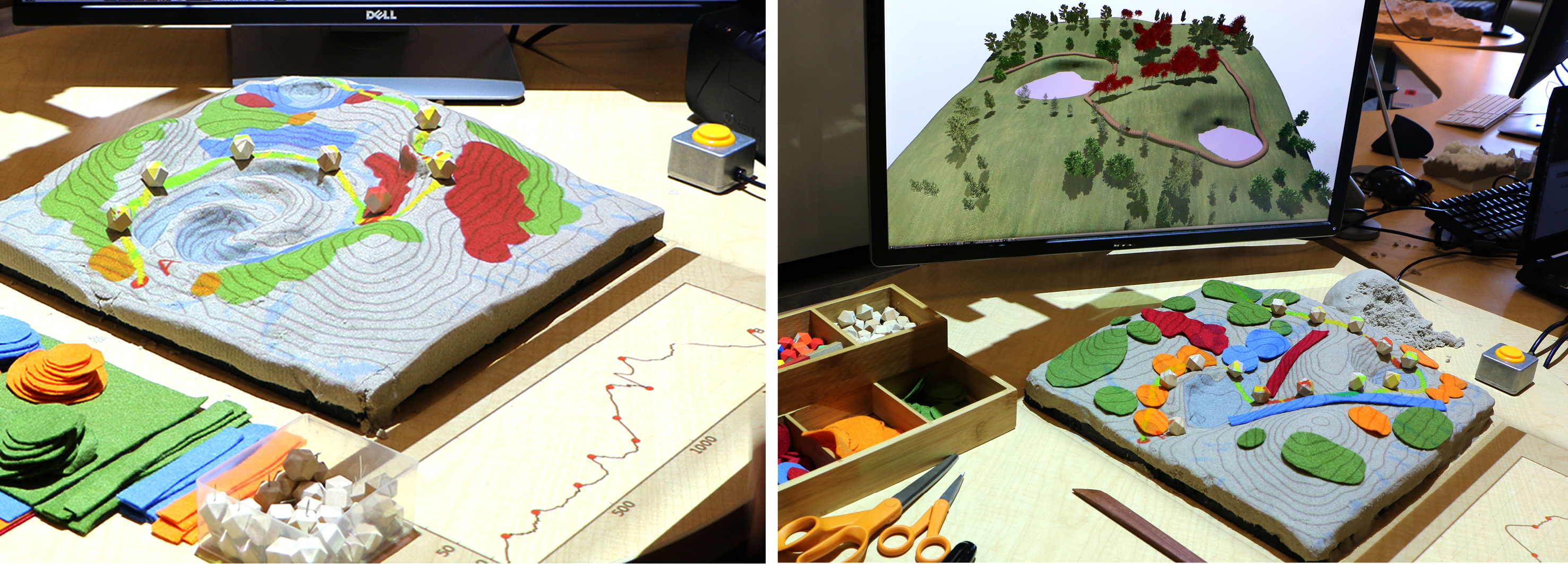
Vegetation
Paths
Cameras
Immersion
Realism
Realism
Road map: Eevee Renderer for Blender 2.8
Tangible Landscape
With robotic fabrication, streaming data, & autonomous construction
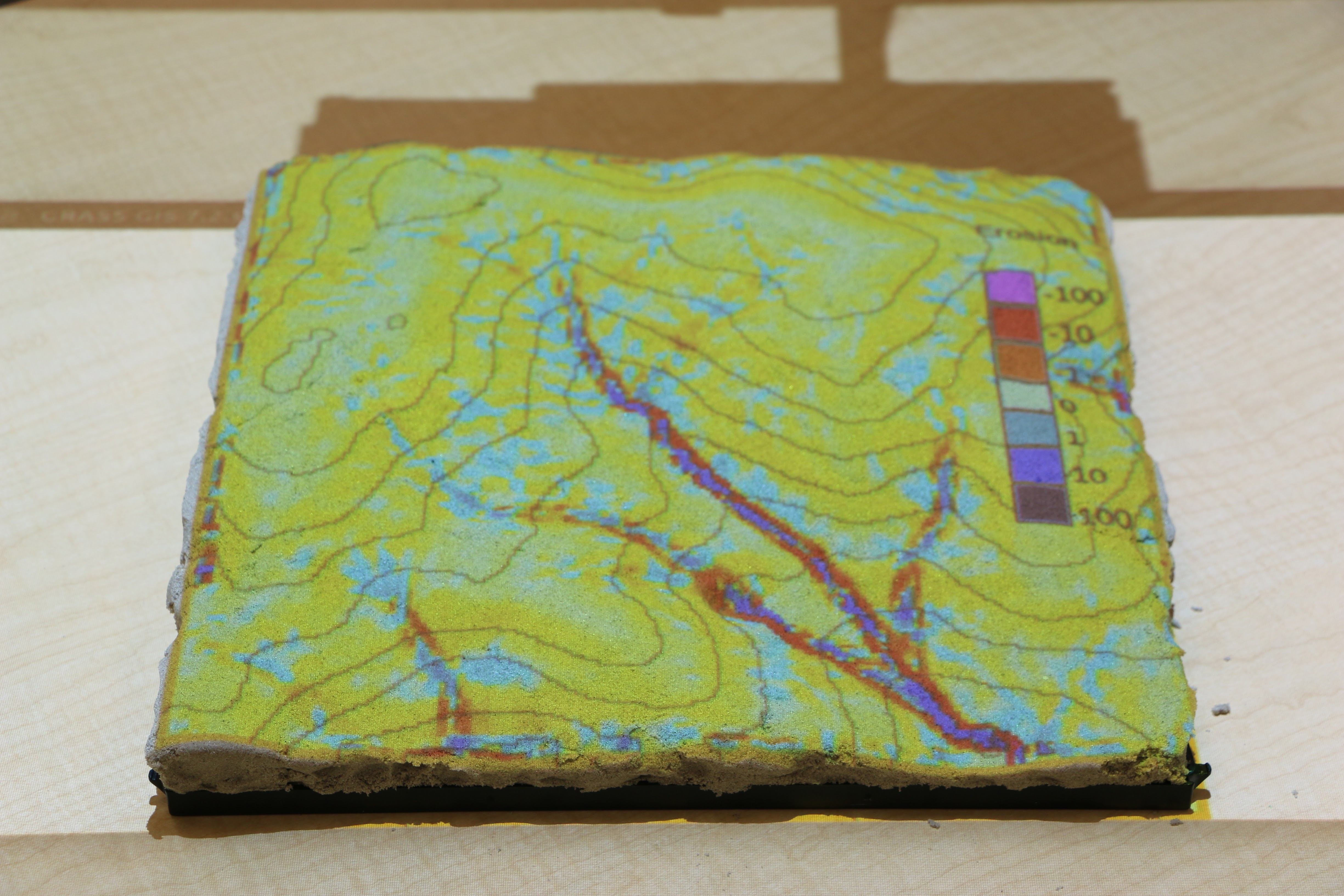
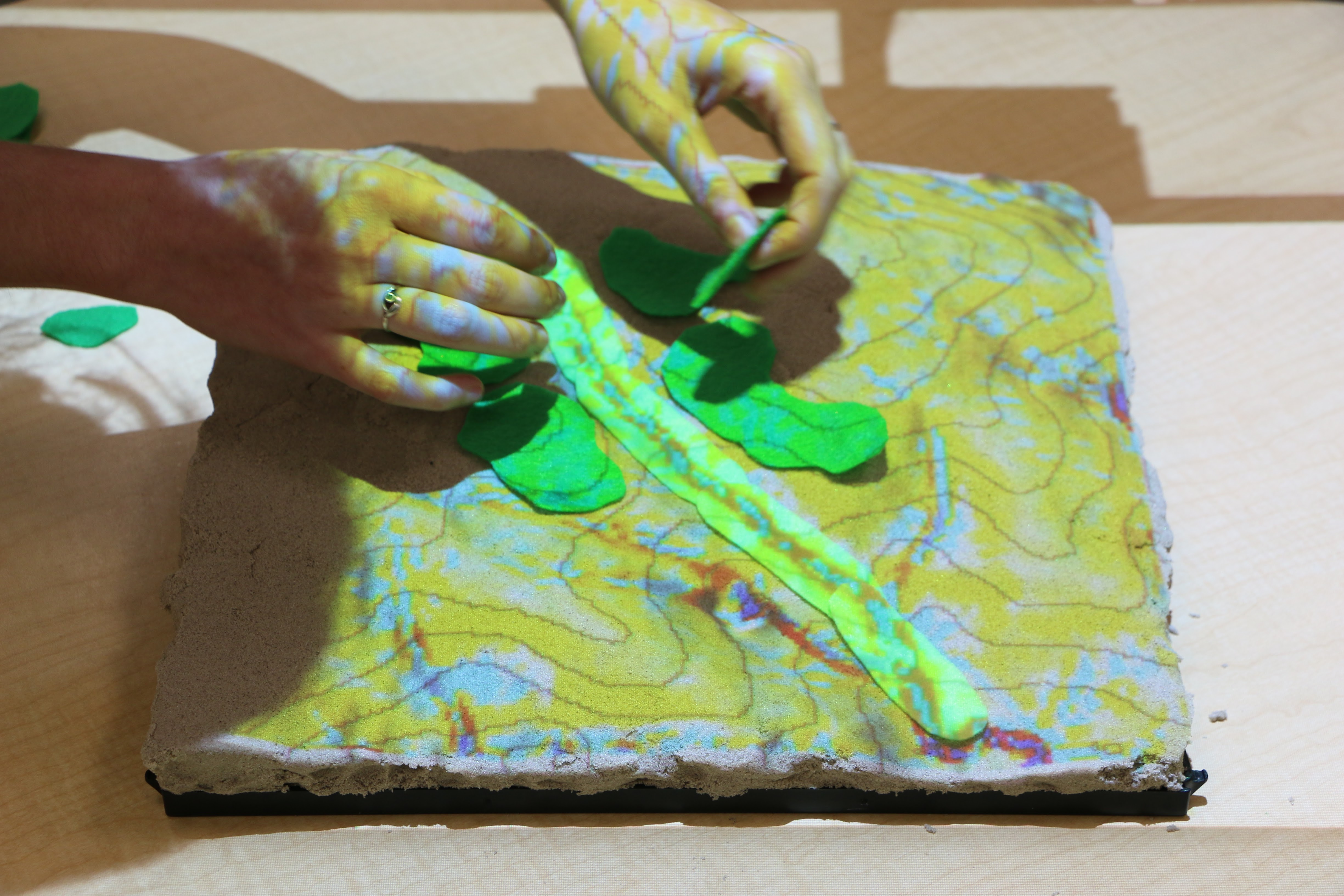
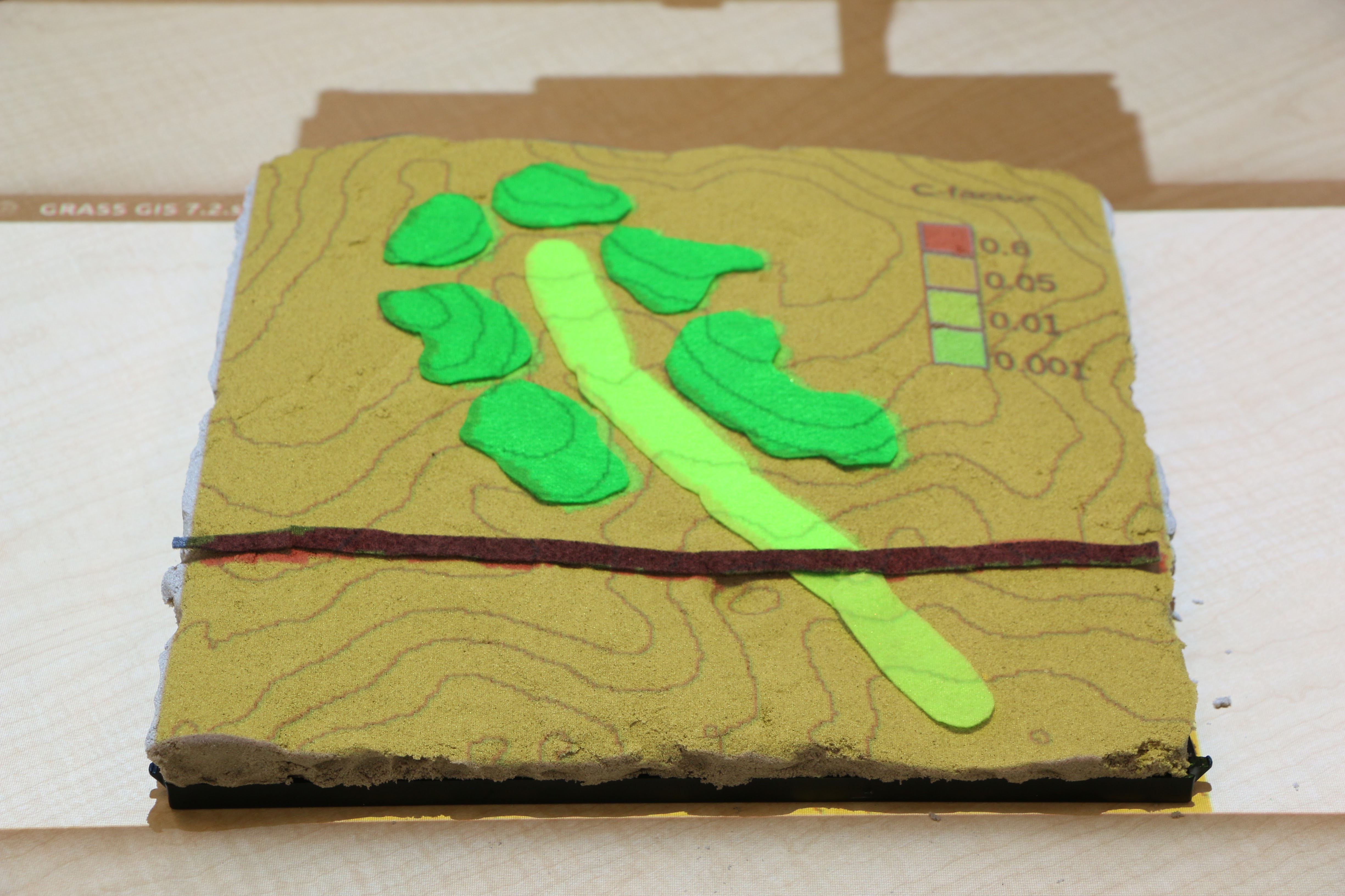
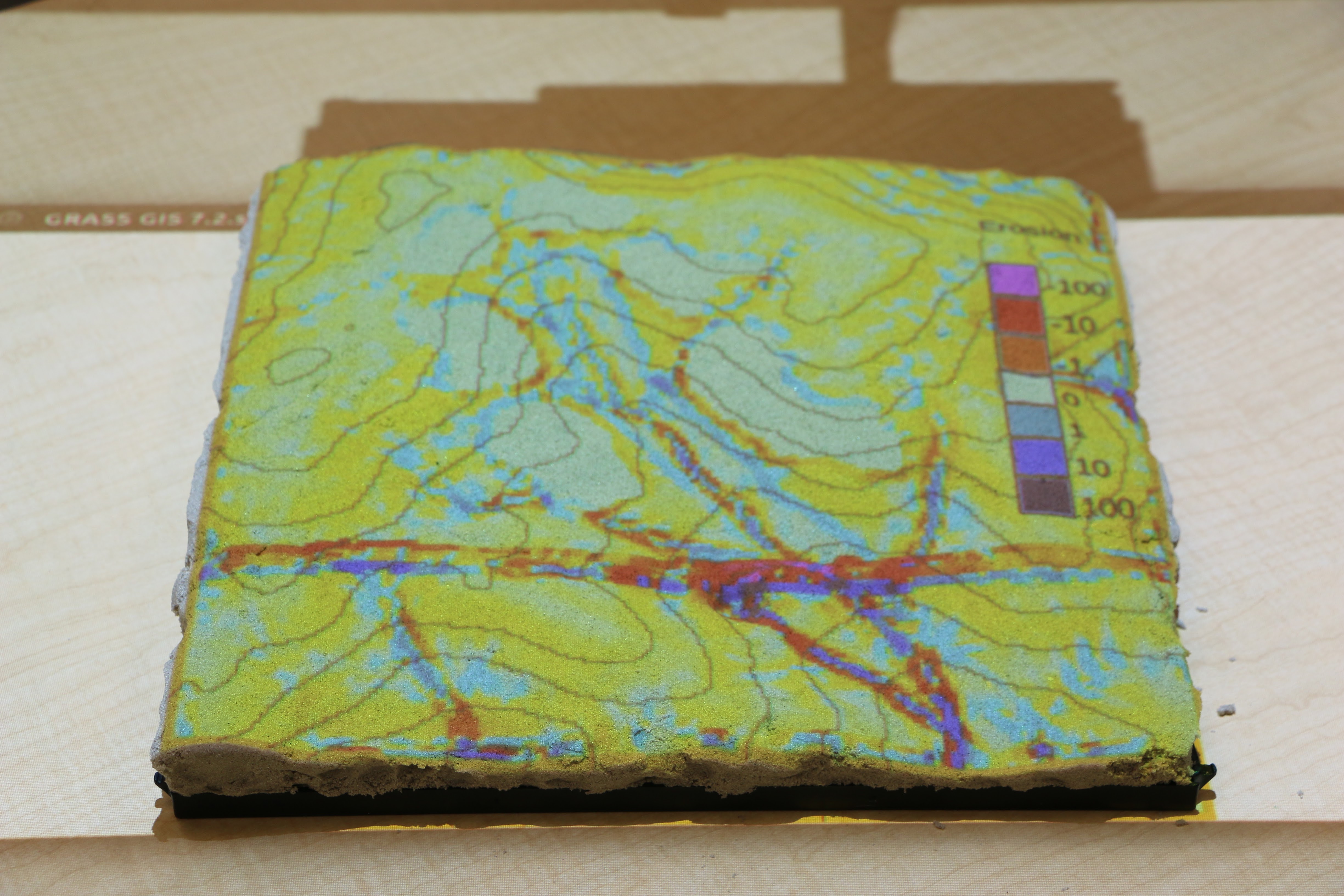
Applications: erosion control
Modifying land cover with colored felt
Applications: visibility
Visibility and line of sight
Applications: solar analysis
Solar irradiation and cast shadows
Applications: wildfire spread
Designing and testing fire breaks
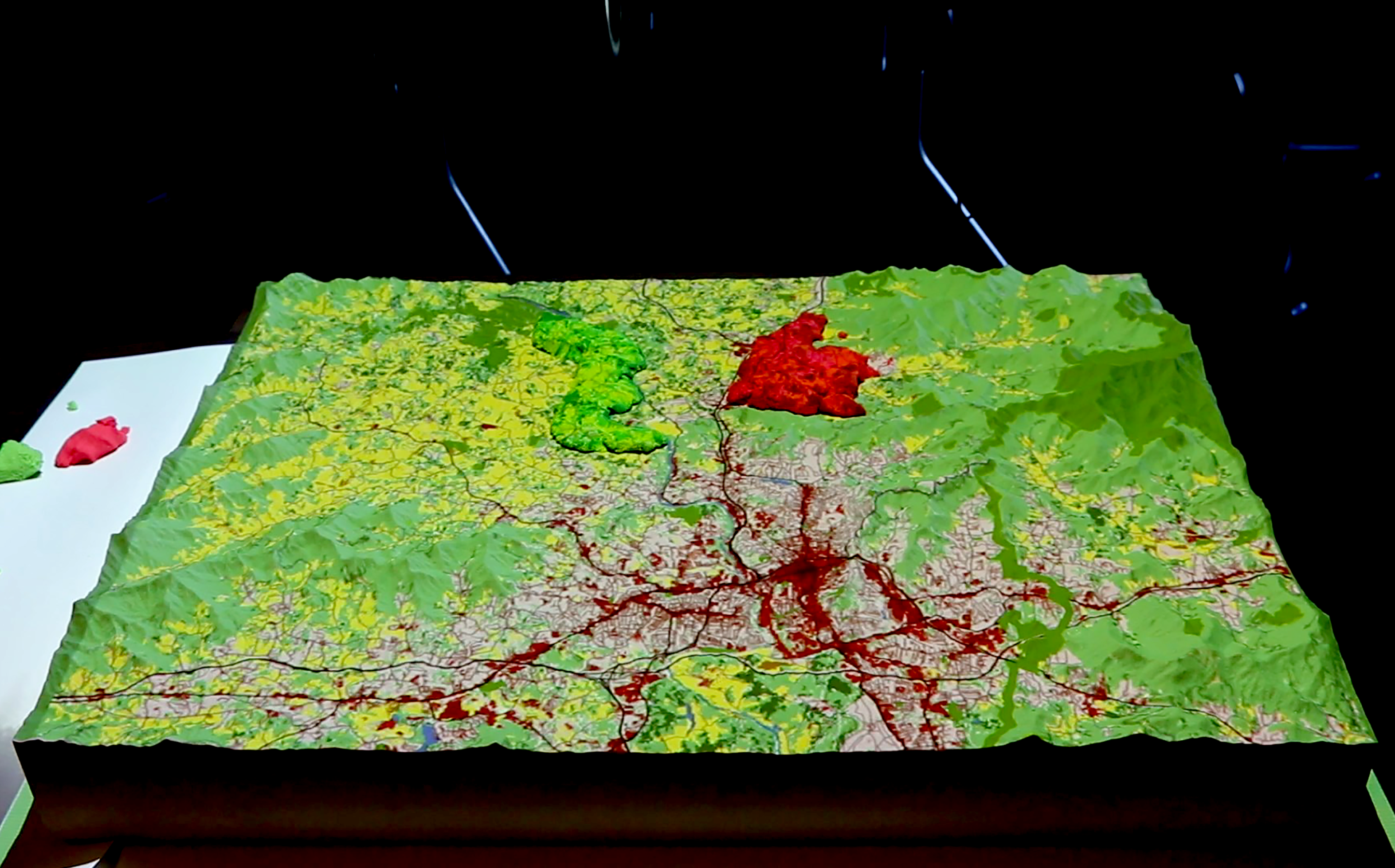
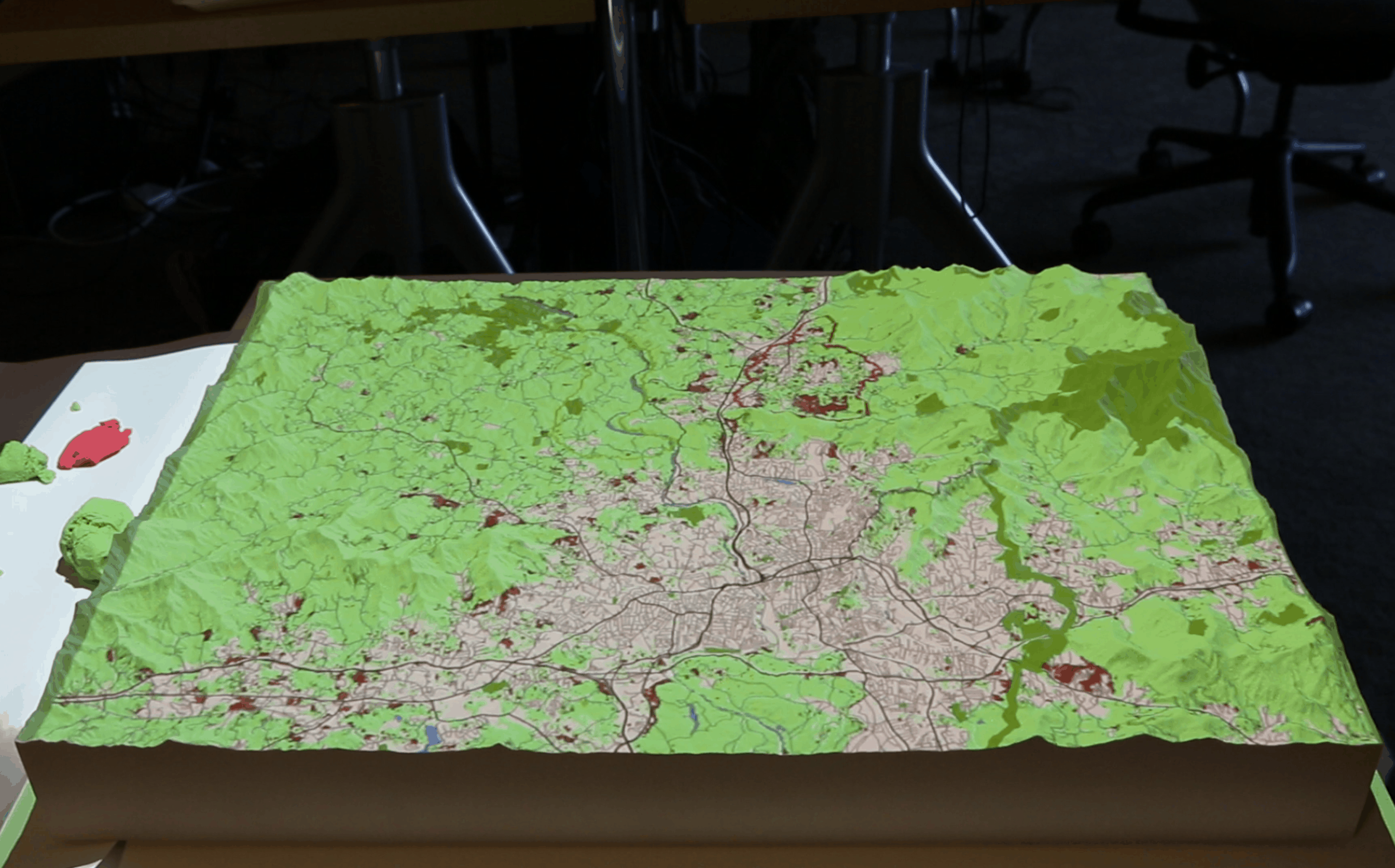
Applications: urban growth
Simulation of urban growth scenarios with FUTURES model
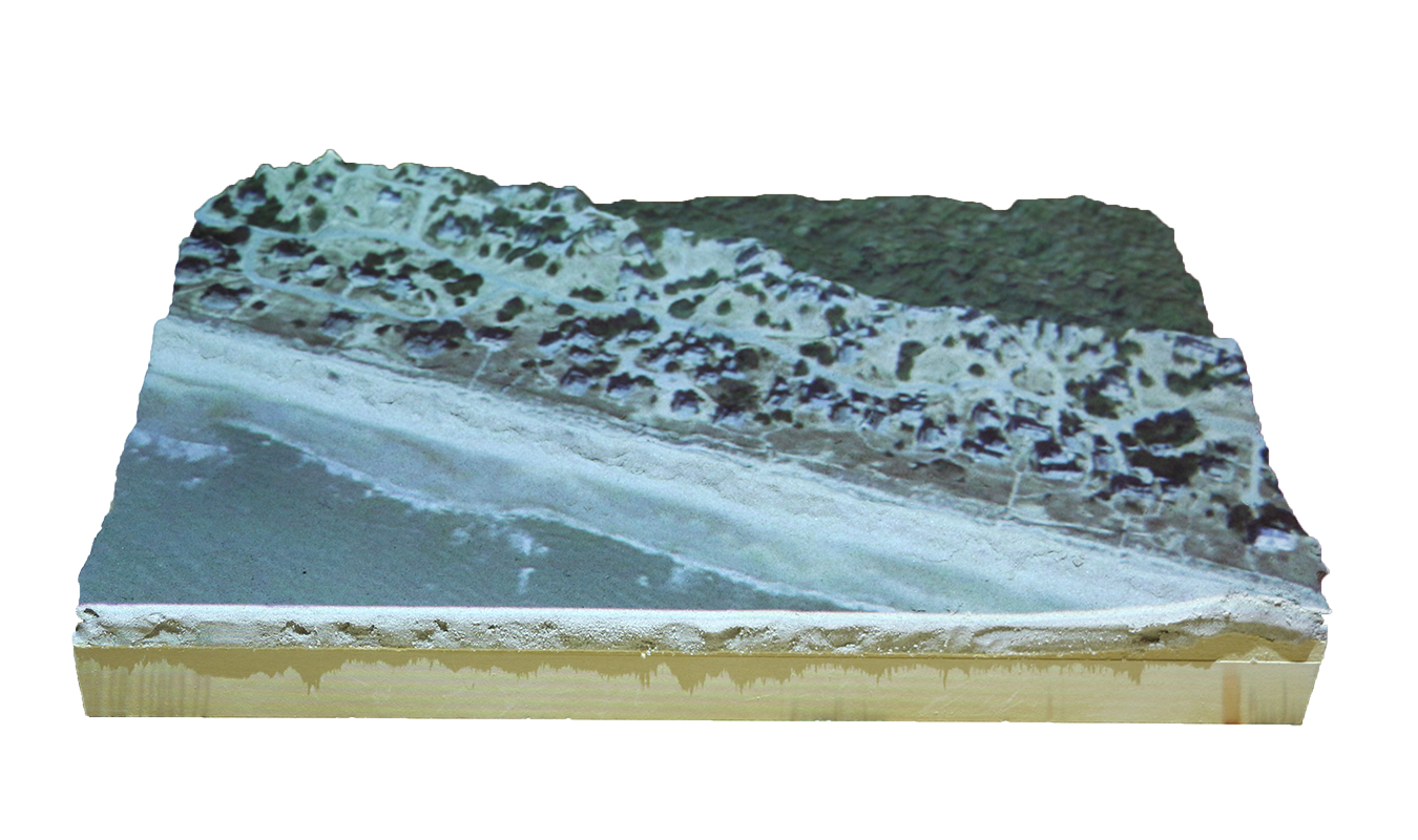
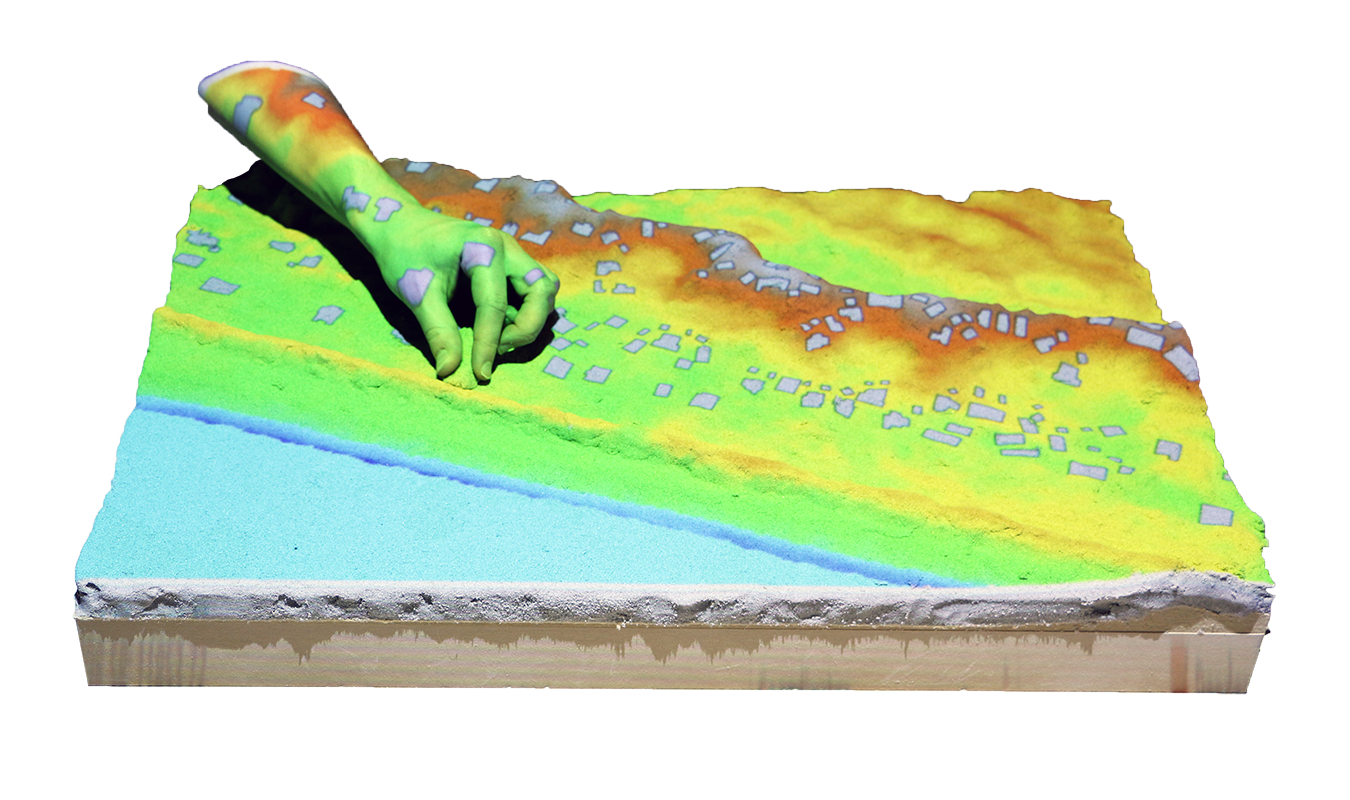
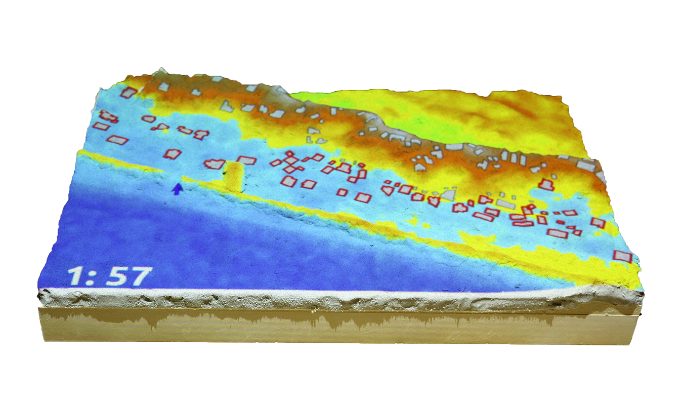
Applications: coastal flooding
Save houses from coastal flooding by building coastal defenses
Structured problem-solving with rules, challenging objectives, and scoring