Integration and Analysis of Lidar and UAS Surveys
to Study Coastal Sand Dunes Evolution and
Changes in Field Microtopography
Helena Mitasova
A. Petrasova, V. Petras, J. Jeziorska, C. Kling
![]()
![]()
Link to this presentation:https://ncsu-geoforall-lab.github.io/dynamic-surfaces-talk/agu2018.html#/
Data acknowledgment: NOAA digital coast, NC Floodplain mapping, NCALM, USACE JALBTCX, USGA/NASA/NOAA coastal mapping, NC NGAT UAS mapping
Multitemporal elevation data
- Lidar surveys along North Carolina coast since 1996
- UAS and SfM made 3D mapping widely accessible
- monitoring dynamic landscapes is now possible at increasingly finer spatial and temporal resolutions
- rapid evolution of technology leads to data with varied properties: often we have to work with multitemporal data rather than time-series
Lidar-based DSM: 1996 and 2008, differences in coverage, accuracy, point density
Hardin, E., Mitasova, H., Tateosian, L., Overton, M., 2014, GIS-based Analysis of Coastal Lidar Time-Series, Springer Briefs in Computer Science, Springer, New York, 84 p.
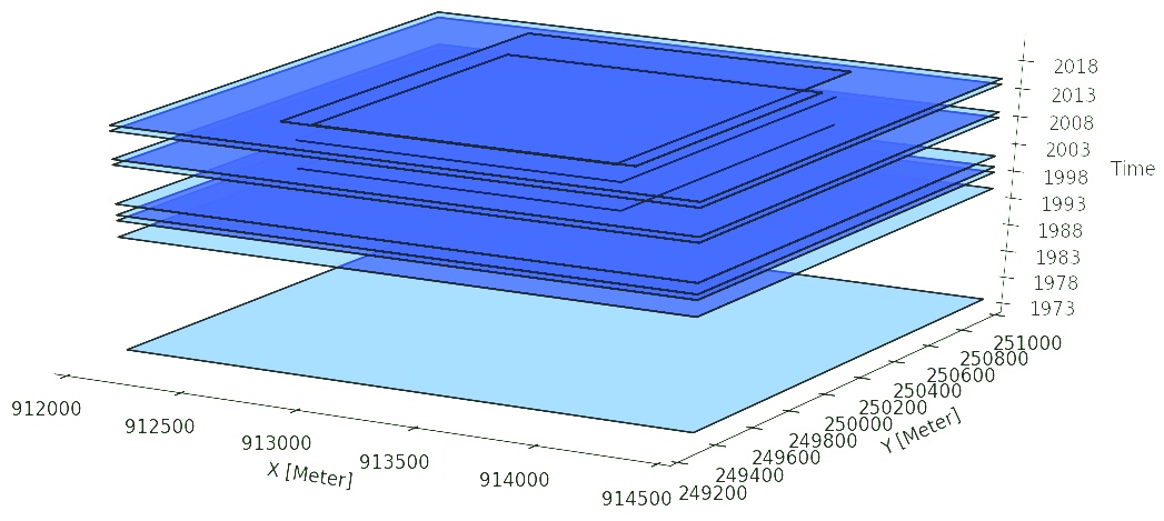
GRASS GIS temporal framework
Efficient management and analysis of multitemporal 2D/3D raster and vector data
Gebbert, S., Pebesma, E., 2014. A temporal GIS for field based environmental modeling. Environmental Modelling and Software 53, 1-12.
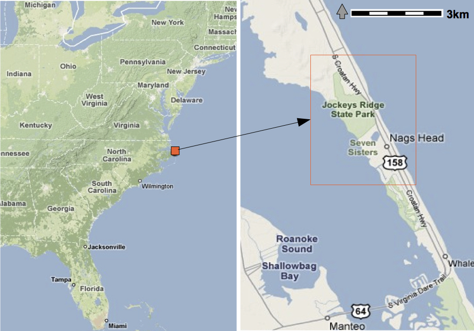
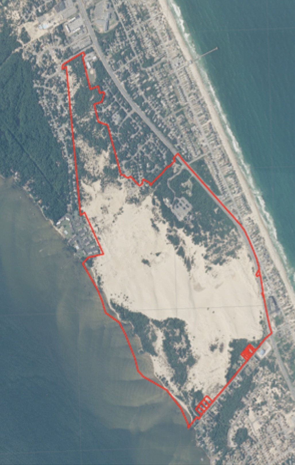
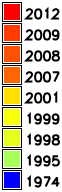
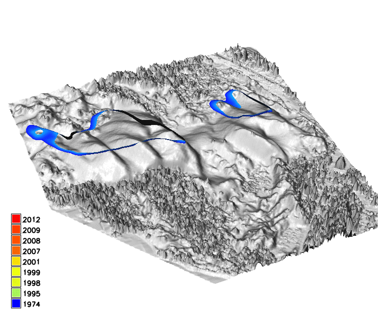
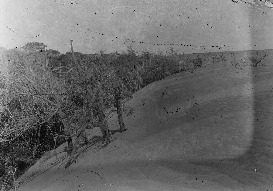
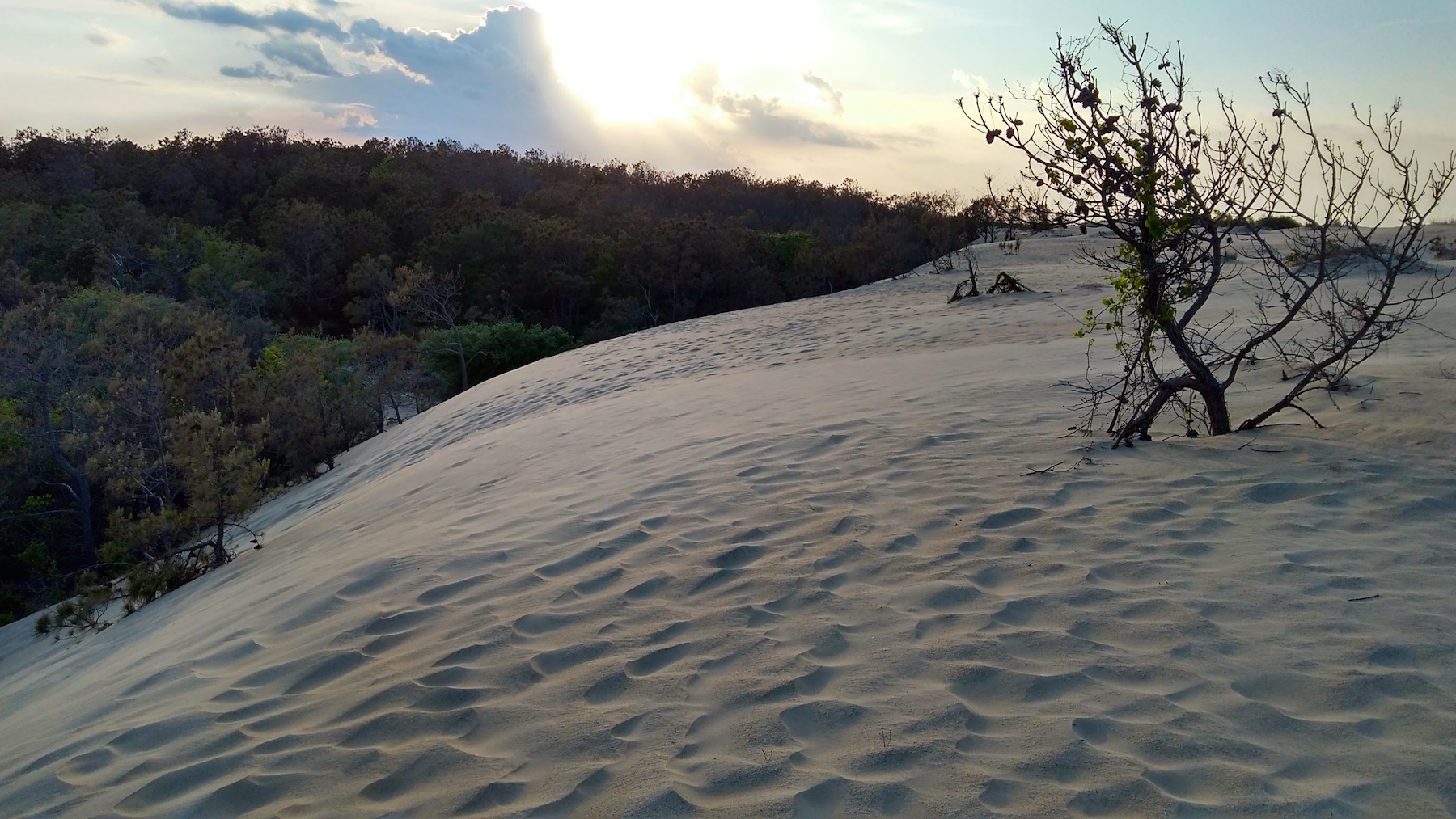
Jockey's Ridge sand dunes
- Largest active dunes on the East coast, state park with static boundaries
- Management challenges: wind blown sand covers structures and roads outside the park, dune lost elevation
Mitas, O., Mitasova, H.; Brothers, G., Weaver, K., 2014, Managing Dune Landscape Changes at Jockey's Ridge State Park, North Carolina, Tourism in Marine Environments 9(3-4), pp. 155-167.
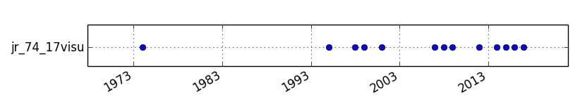
Coastal multitemporal elevation data
- photogrammetry: 1974, 1995, 1998
- lidar: 1999,2001,2007,2008,2009,2012,2014,2015 (7/2018,10/2018)
- structure from motion from UAS imagery: 2016,2017
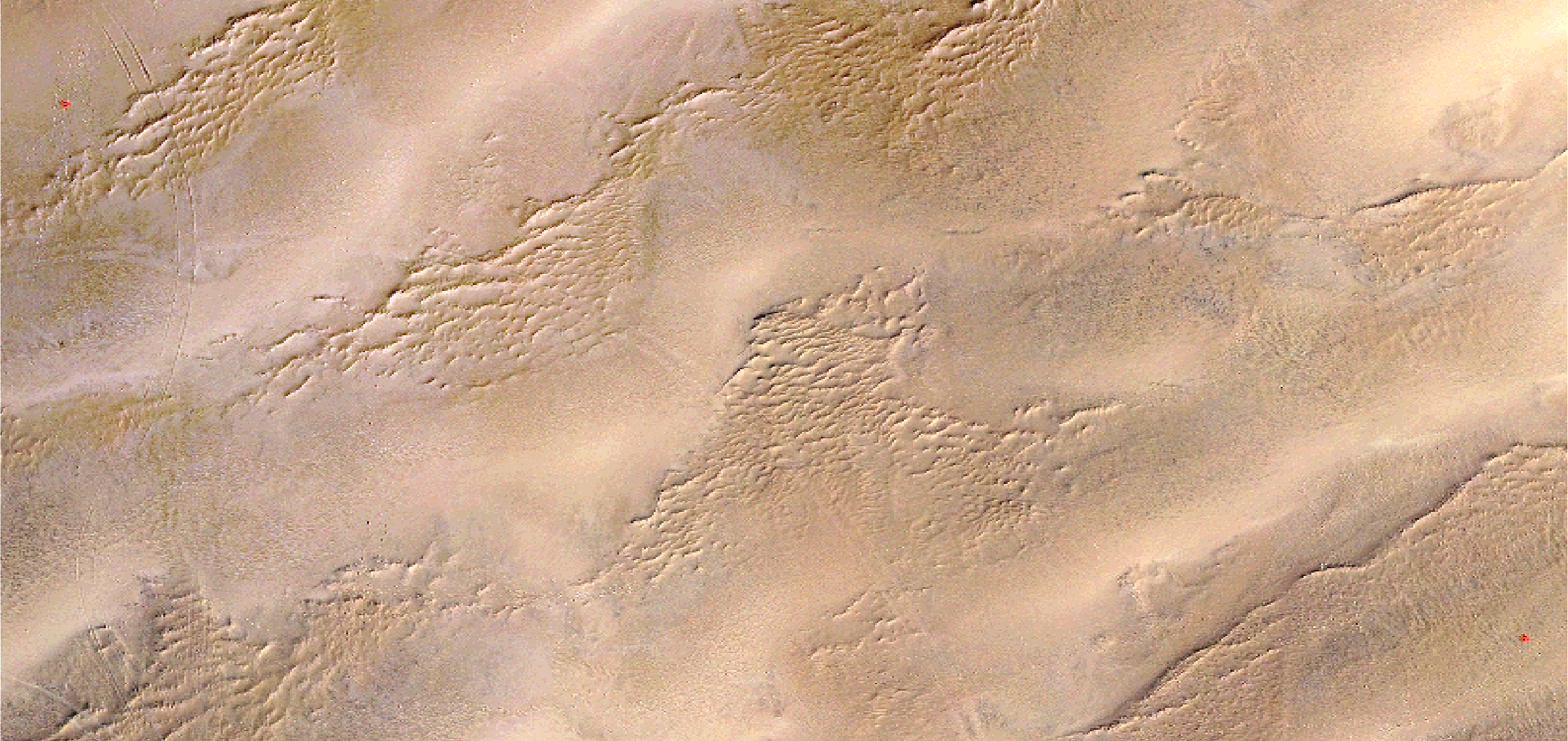
1974 1998 1999
2001 2009 2015
vertical / horiz. accuracy: 0.7 / 0.4 m photogrammetry, 0.15 / 0.2 - 0.8 m lidar
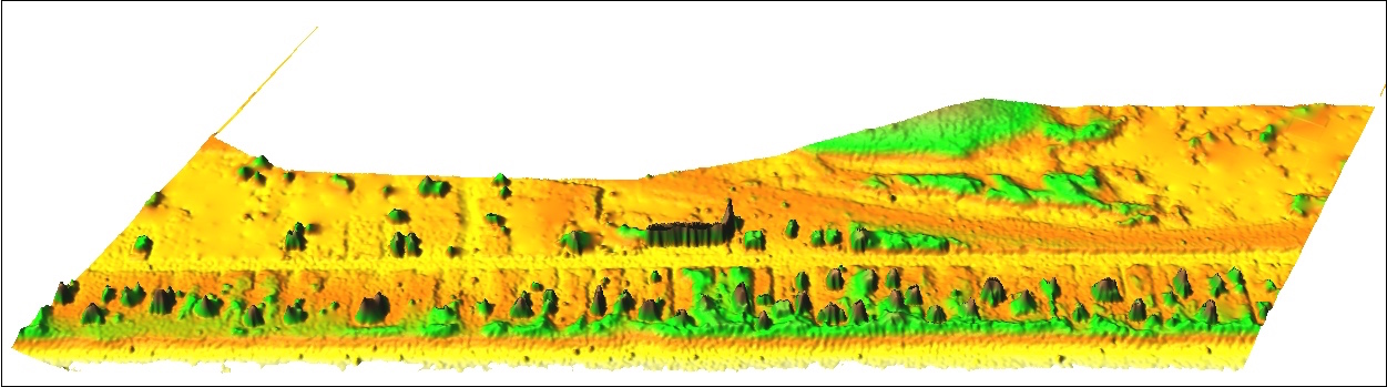
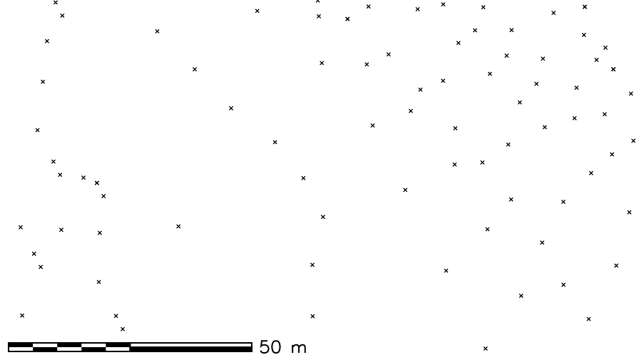
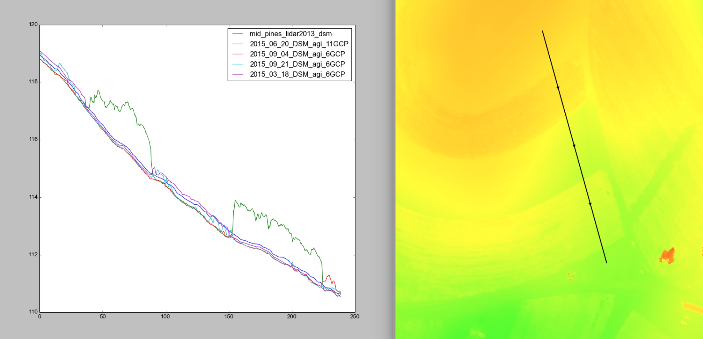
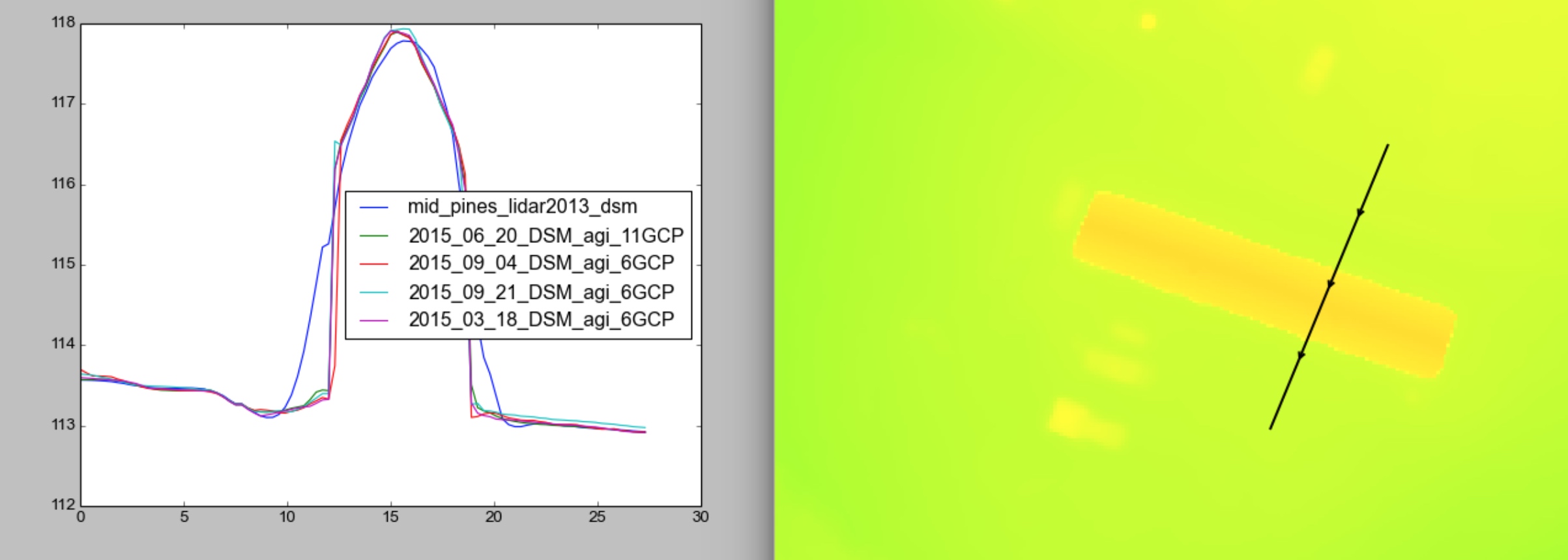
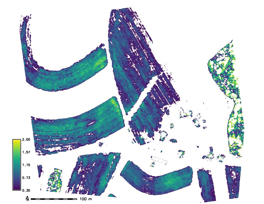
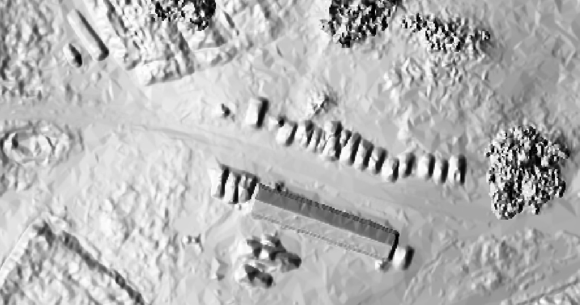
Processing DEMs
- 1m resolution DEMs: interpolated with regularized spline with tension
- Elevations along I-158 were extracted to evaluate systematic errors
- UAS survey did not cover the road, GCPs on dune were used
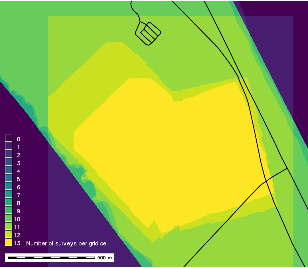
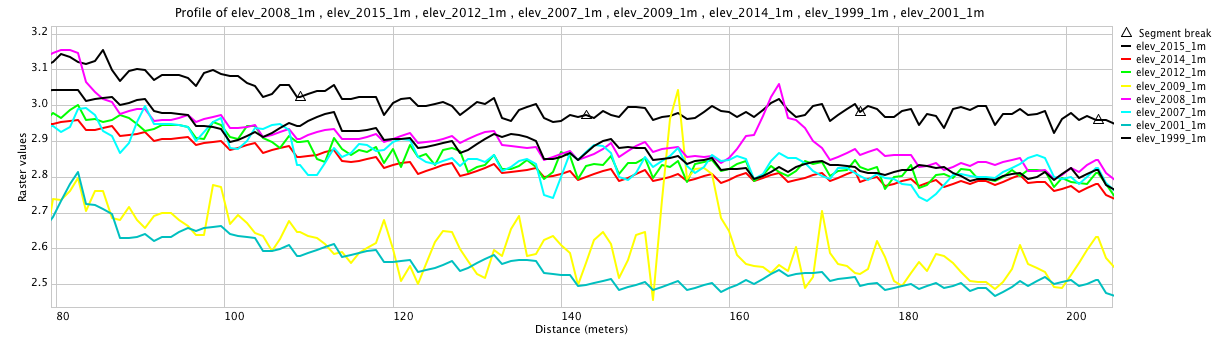
number of surveys per grid cell profiles along I-158 road section from lidar DEMs 1999-2015
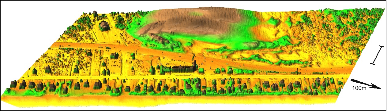
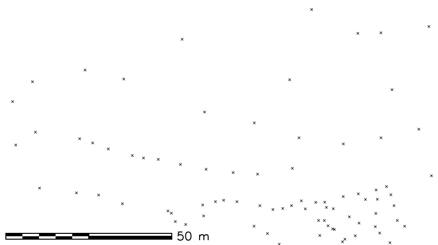
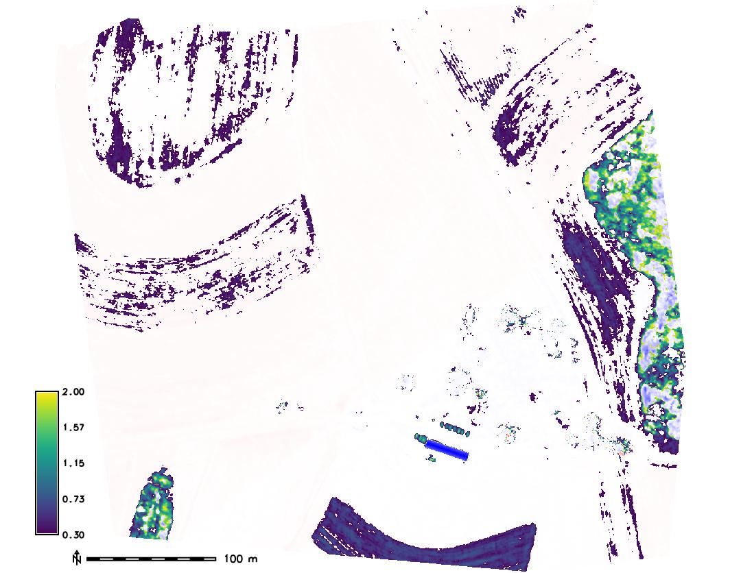
Processing DEMs
- 1m resolution DEMs: interpolated with regularized spline with tension
- Elevations along I-158 were extracted to evaluate systematic errors
- UAS survey did not cover the road, GCPs on dune were used
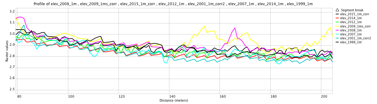
number of surveys per grid cell profiles along I-158 section: corrected lidar DEMs 1999-2015
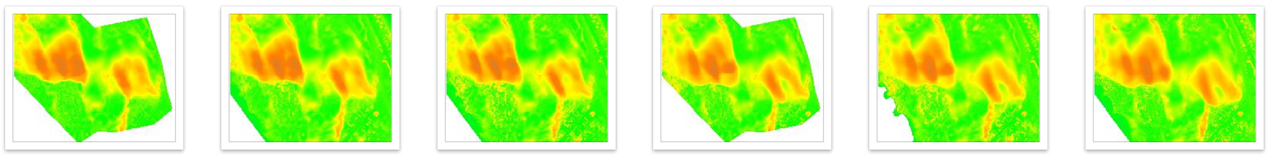
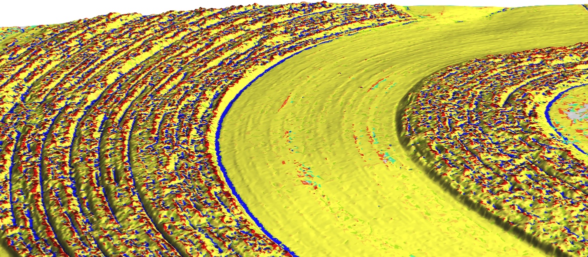
DEM time series visualization
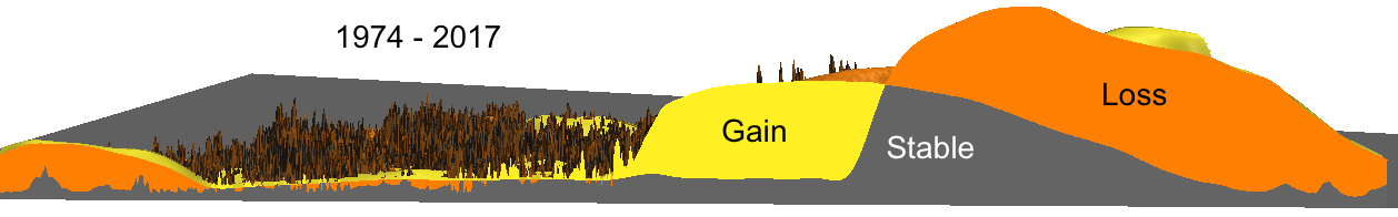
Jockey's Ridge 1974 - 2017: southward migration at 3-6 m/yr, landform transformation
from crescentic dune to sand starved, fast moving parabolic dunes
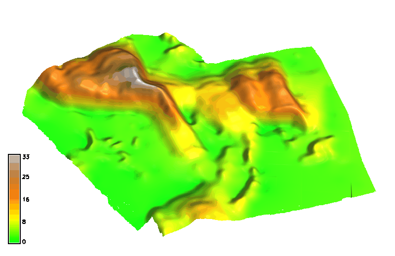

DEM time series visualization 1974 - 2017
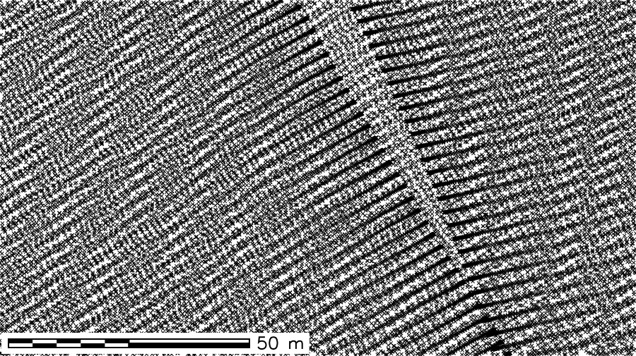
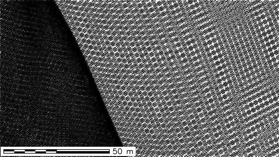
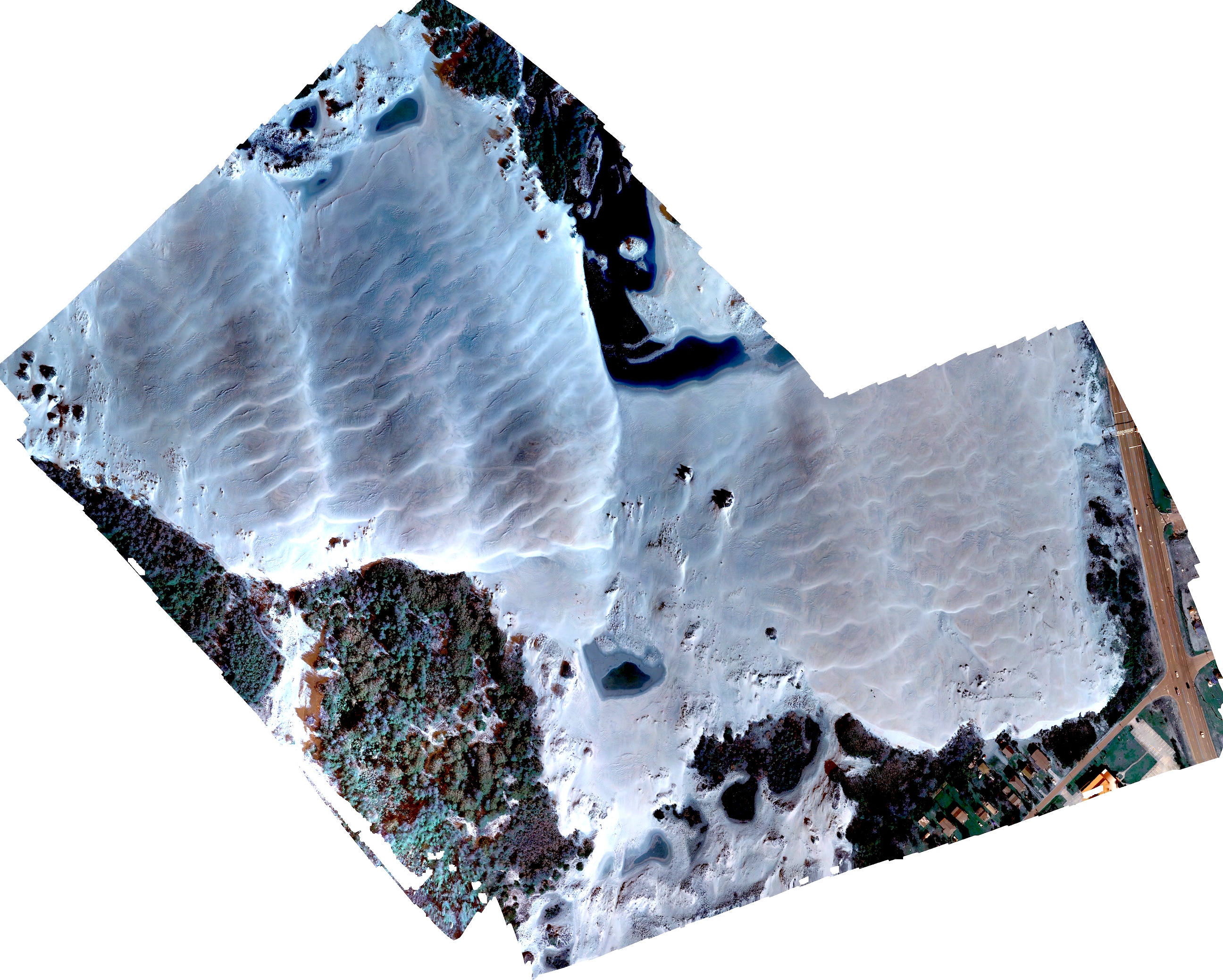
Post-hurricane Mathews ripples
Orthphoto from UAS survey, october 2016
Annual dynamics from Planet imagery
Satellite imagery at 3m resolution, September 2017 - July 2018, captures impact of storm in March 2018 with large ripples similar to those observed post Mathews
Planet: world’s largest constellation of Earth-imaging (micro) satellites providing daily observations for entire Earth at 3m resolution
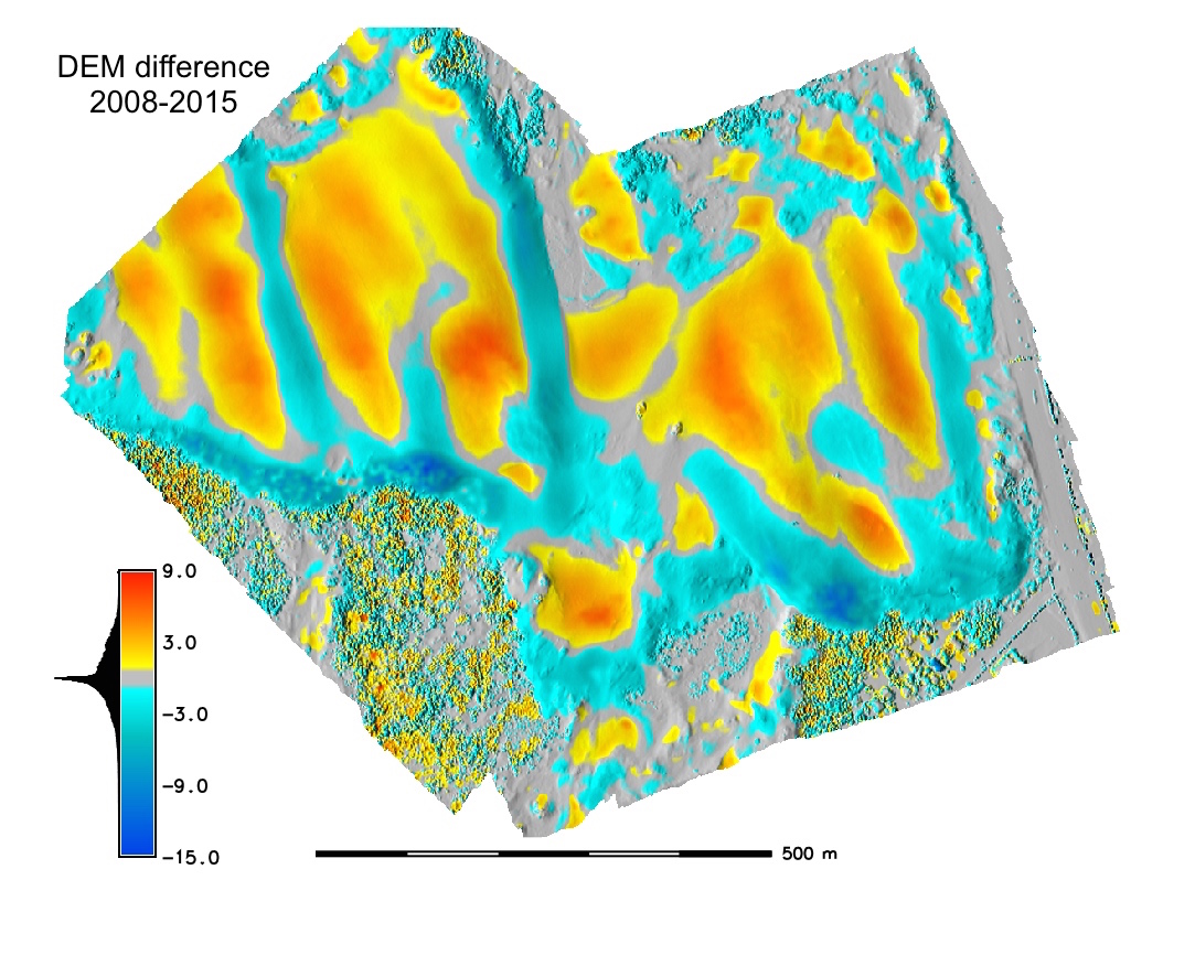
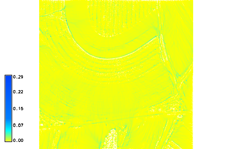
Complex pattern of changes
- DEM differences show both loss and increase in elevation
- total sand volume is stable (~3.5 mil cubic m)
- volume of core (sand not moved between 1974-2017) is only 30% of total volume
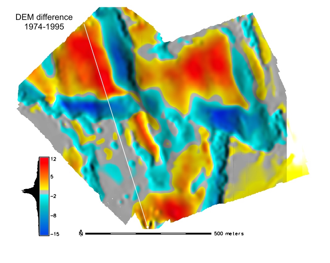
Overlayed DEMs 1974 - 2017: crossections
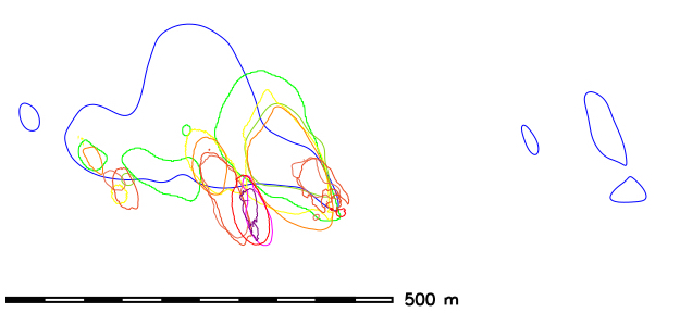
Landform change: contours time series
Dune gradually split into smaller parabolic dunes: contours capture the landform change but they are hard to read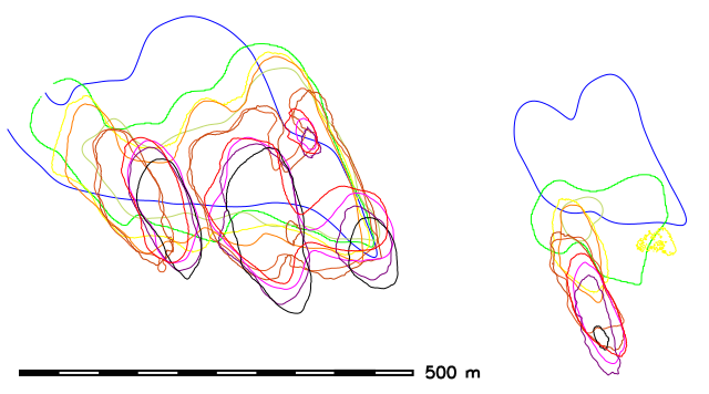 16m
16m
 20m
20m
Space-Time cube visualization
DEM time series is converted into space-time voxel model in TGRASS and evolution of a contour is represented as isosurface: 16m and 20m
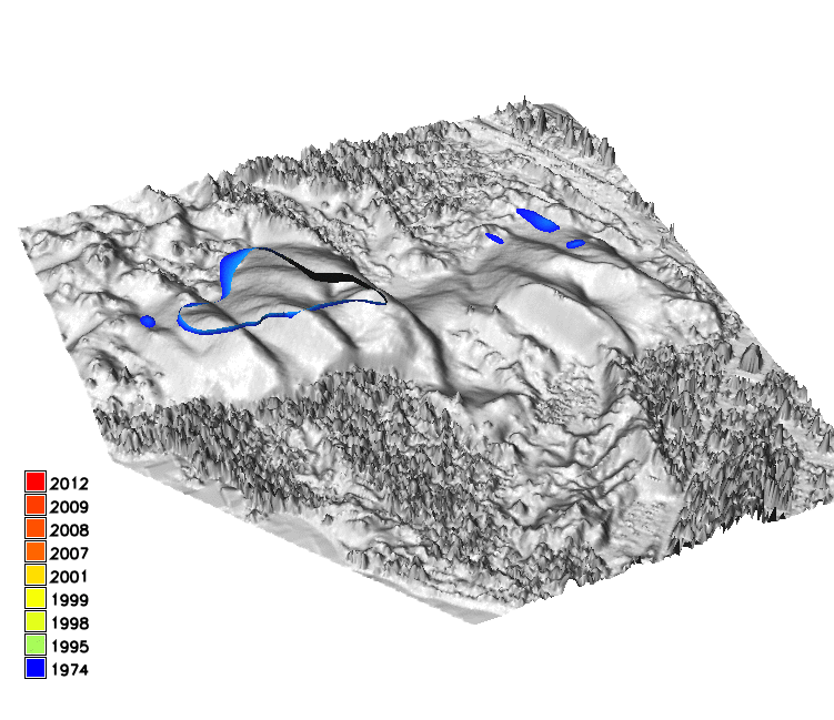
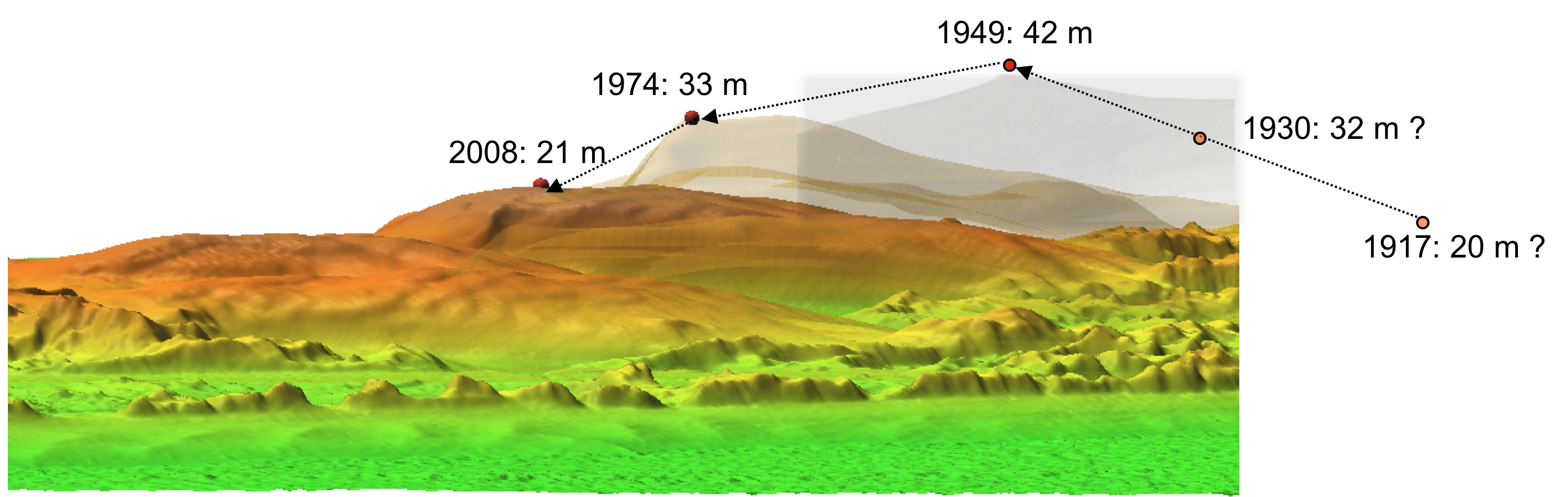
Peak elevation change
- linear trend in loss of peak elevation at 0.3 m/yr, from 43 m to 20 m
- accelerating horizontal migration
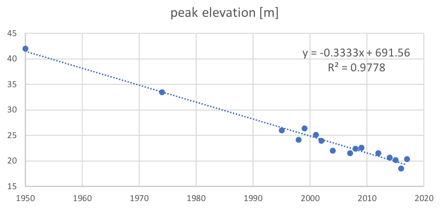
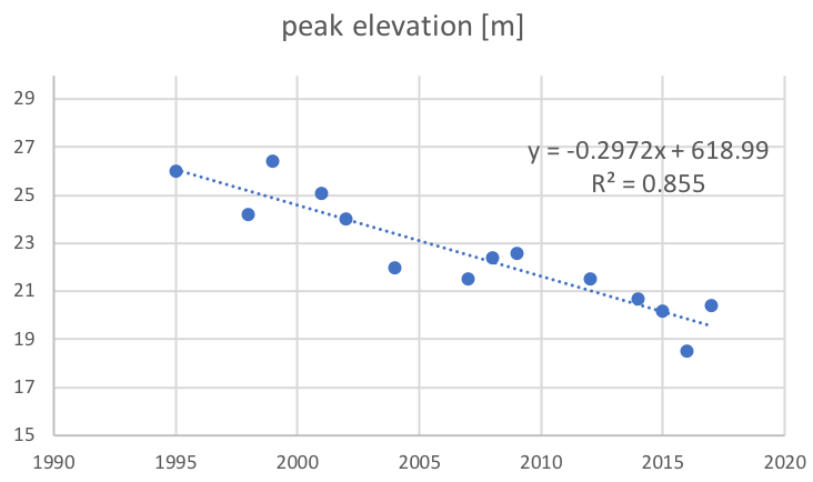
Location of peak migrates following dune transformation
Peak elevation change
- growth between 1917 - 1949, reconstruct DEM from 1949 and 60s imagery
- accelerating horizontal migration
Location of peak migrates following dune transformation
Jockey's Ridge story
The 43 m high dune was a transient landform,
transitioned between forest and active dunes over the past 2000 years
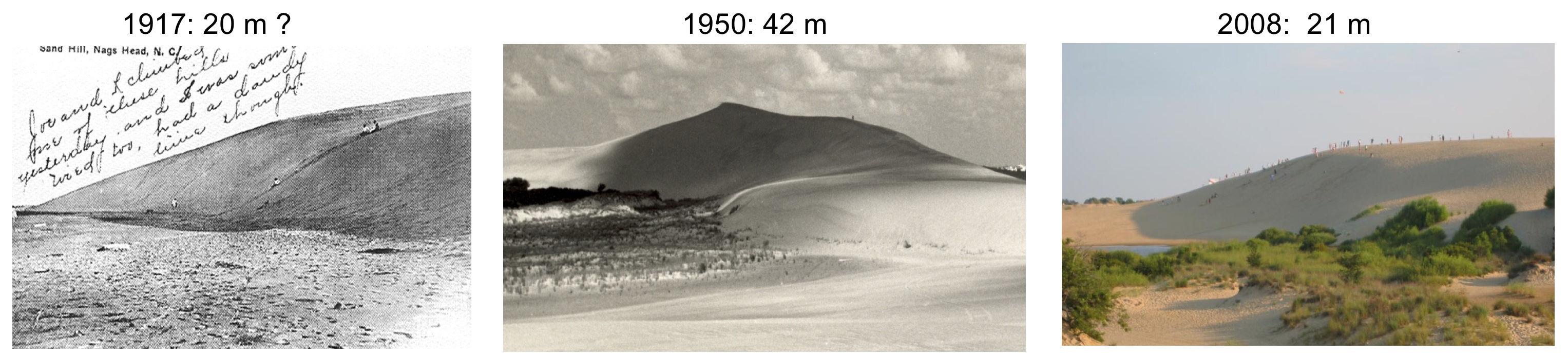
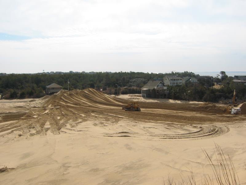
Dune in early 1900 and in 2016, sand removal at the park boundary in 2003
Agricultural field monitoring
- UAS based monitoring of field microtopography and crop topography
- 28 UAS surveys, 2 lidar surveys
- 4 different UAS platforms (Trimble UX5, eBee Plus, DJI Inspire, Phantom 3)
- Agisoft Photoscan, GRASS GIS temporal framework
- fusion with lidar for watershed modeling
- used in courses and for student projects

Jeziorska, J., Montgomery, K., Mitasova, H. 2018, Microtopography and Crop Vigor Changes Assessment Using Time Series of UAS Derived Data.
AGU Fall 2018 meeting poster B33F-2378
Petrasova, A., Mitasova, H., Petras, V., Jeziorska, J., 2017, Fusion of high-resolution DEMs for water flow modeling, Open Geospatial Data, Software and Standards 2(6)
Jeziorska, J; Mitasova, H; Petrasova, A; Petras, V; Divakaran, D; Zajkowski, T., 2016, Overland flow analysis using time series of sUAS-derived elevation models, ISPRS Ann. Photogramm. Remote Sens. Spatial Inf. Sci., III-8, 159-166. DOI:10.5194/isprs-annals-III-8-159-2016
Multitemporal surface analysis
Differences along profiles in the field and over a building
Crop surface analysis
Differences in crop height
Geomorphons: crop row analysis, and max elevation over time: cumulative locations for parking
Ultra-high resolution water flow: UAS mapping
Modeling impact of tillage and rills on surface water flow using 0.25m resolution DEM derived by SfM from overlapping UAS imagery
Conclusion
Multitemporal mapping of evolving landforms brings new insights into landscape dynamics
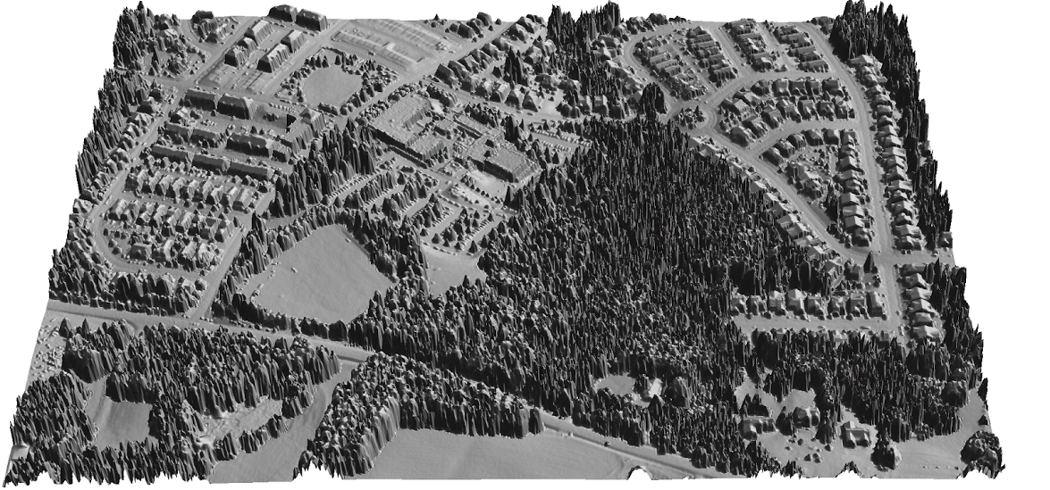
Next step - evolution of urban topography
2015 lidar updated with 2018 UAS data: forested are replaced by a new school
Open Science
Developing open source software and contributing to OSGeo projects:
GRASS GIS https://grass.osgeo.org/
Tangible Landscape tangible-landscape.github.io
Open access educational material:
NCSU GeoForAll Lab Courses and Workshops https://geospatial.ncsu.edu/geoforall/courses.html
Supplemental material
GCPs on the Jockey's Ridge dune for the 2016 UAS survey